Winston-Salem night lights from space
Night Light of Winston-Salem (North Carolina) from space (United States) Src. Average luminocity for 10x10km area is 93.7179% and for 50x50km: 41.4268%.
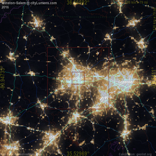
Analysis of Winston-Salem night lights 2016
Square area 10x10 km:
 38.28%
90-99
33.33%80-89
16.67%70-79
11.54%60-69
0.18%50-59
0%40-49
0%30-39
0%20-29
0%10-19
0%0-9
0%Square area 50x50 km:
5.74%90-99
6.13%80-89
6.95%70-79
7.91%60-69
9.3%50-59
6.06%40-49
6.22%30-39
5.53%20-29
6.75%10-19
11.05%0-9
28.35%Clear (daylight) street map image can be seen on geolist.org.
Map coordinates:
36° 39' 57.3" North, 80° 56' 50.5" West
36° 5' 59.5" North, 80° 14' 39.2" West
35° 31' 46.9" North, 79° 32' 28" West
Some cities around Winston-Salem sort by population:
• High Point
26.8 km =16.7 mi,  126°
126°
• Thomasville
28.2 km =17.5 mi,  148°
148°
• Kernersville
15.5 km =9.6 mi,  81°
81°
• Clemmons
15.1 km =9.4 mi,  234°
234°
• Lewisville
15.7 km =9.8 mi,  268°
268°
• King
22.6 km =14 mi,  332°
332°
• Oak Ridge
24.3 km =15.1 mi,  70°
70°
• Stokesdale
28.2 km =17.5 mi,  57°
57°
4499612 (p: 241,218)
Sources (retrieved 2019-11-25):
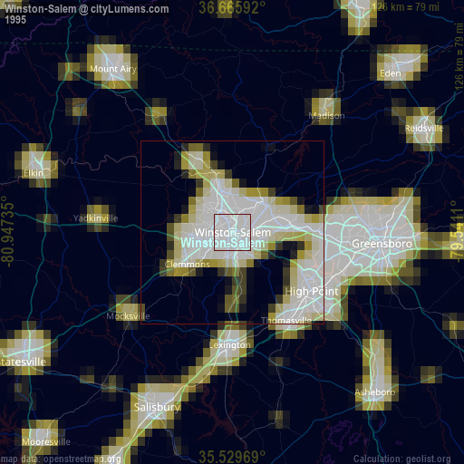
» NASA, Earths city lights 1995
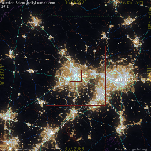
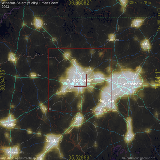
» NASA city lights 2003
» Earth at Night: Flat Maps 2012, 2016