King night lights from space
Night Light of King (North Carolina) from space (United States) Src. Average luminocity for 10x10km area is 35.1958% and for 50x50km: 20.5452%.
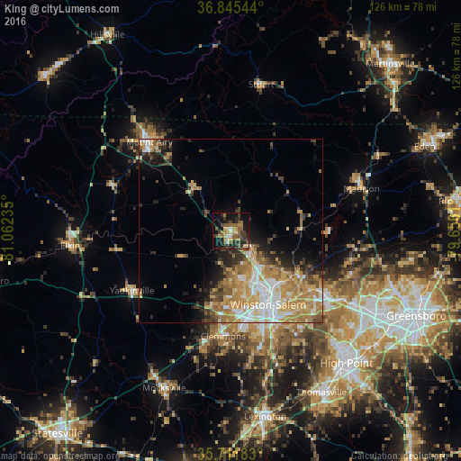
Analysis of King night lights 2016
Square area 10x10 km:
 1.57%
1.57%90-99
1.4%80-89
6.47%70-79
5.07%60-69
6.82%50-59
8.92%40-49
5.42%30-39
10.84%20-29
12.41%10-19
26.05%0-9
15.03%Square area 50x50 km:
3.05%90-99
3.08%80-89
3.4%70-79
4.35%60-69
4.48%50-59
2.18%40-49
2.25%30-39
2.72%20-29
3.3%10-19
5.69%0-9
65.49%Clear (daylight) street map image can be seen on geolist.org.
Map coordinates:
36° 50' 43.6" North, 81° 3' 44.5" West
36° 16' 50.5" North, 80° 21' 33.2" West
35° 42' 42.6" North, 79° 39' 22" West
Some cities around King sort by population:
• Winston-Salem
22.6 km =14 mi,  152°
152°
• Kernersville
31.2 km =19.4 mi,  124°
124°
• Clemmons
28.9 km =18 mi,  184°
184°
• Lewisville
21.1 km =13.1 mi,  194°
194°
• Summerfield
41.5 km =25.8 mi,  101°
101°
• Mount Airy
32.9 km =20.4 mi,  317°
317°
• Oak Ridge
35.3 km =21.9 mi,  109°
109°
• Stokesdale
34.4 km =21.4 mi, 98°
4474316 (p: 7,059)
Sources (retrieved 2019-11-25):
» Earth at Night: Flat Maps 2012, 2016