Willimantic night lights from space
Night Light of Willimantic (Connecticut) from space (United States) Src. Average luminocity for 10x10km area is 29.3474% and for 50x50km: 10.4452%.
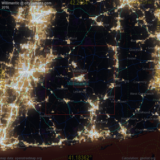
Analysis of Willimantic night lights 2016
Square area 10x10 km:
 4.55%
4.55%90-99
5.36%80-89
4.38%70-79
1.79%60-69
5.03%50-59
2.6%40-49
1.62%30-39
3.41%20-29
6.33%10-19
34.9%0-9
30.03%Square area 50x50 km:
0.77%90-99
1.21%80-89
1.9%70-79
1%60-69
1.37%50-59
1.45%40-49
1.56%30-39
1.36%20-29
3.03%10-19
8.9%0-9
77.45%Clear (daylight) street map image can be seen on geolist.org.
Map coordinates:
42° 14' 0.2" North, 72° 54' 40.5" West
41° 42' 38.3" North, 72° 12' 29.3" West
41° 11' 1" North, 71° 30' 18" West
Some cities around Willimantic sort by population:
• Norwich
23.5 km =14.6 mi,  152°
152°
• Mansfield City
6.5 km =4 mi,  340°
340°
• Windham
4.4 km =2.7 mi,  105°
105°
• Montville Center
26.2 km =16.3 mi,  169°
169°
• Plainfield
24.6 km =15.3 mi,  98°
98°
• Storrs
11.4 km =7.1 mi, 342°
• Tolland
22.3 km =13.9 mi,  323°
323°
• Hebron
14.4 km =8.9 mi,  245°
245°
4845823 (p: 17,737)
Sources (retrieved 2019-11-25):
» Earth at Night: Flat Maps 2012, 2016