Mansfield City night lights from space
Night Light of Mansfield City (Connecticut) from space (United States) Src. Average luminocity for 10x10km area is 26.9854% and for 50x50km: 10.2607%.
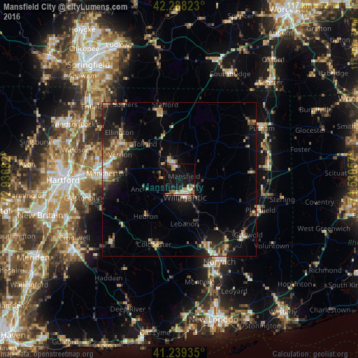
Analysis of Mansfield City night lights 2016
Square area 10x10 km:
 3.73%
3.73%90-99
4.87%80-89
4.55%70-79
2.92%60-69
3.9%50-59
1.14%40-49
1.62%30-39
1.46%20-29
3.25%10-19
43.99%0-9
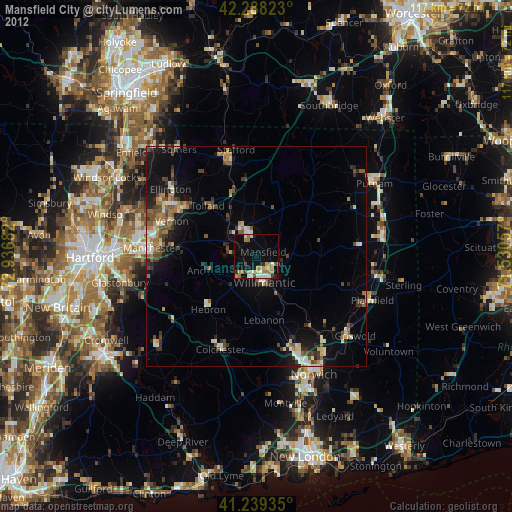
28.57%Square area 50x50 km:
0.65%90-99
1.09%80-89
1.73%70-79
1.07%60-69
1.51%50-59
1.66%40-49
1.49%30-39
1.57%20-29
2.93%10-19
8.35%0-9
77.96%Clear (daylight) street map image can be seen on geolist.org.
Map coordinates:
42° 17' 17.6" North, 72° 56' 12.6" West
41° 45' 57.3" North, 72° 14' 1.3" West
41° 14' 21.7" North, 71° 31' 50.1" West
Some cities around Mansfield City sort by population:
• Manchester
23.9 km =14.9 mi,  272°
272°
• Windham
9.7 km =6 mi,  139°
139°
• Willimantic
6.5 km =4 mi,  160°
160°
• Storrs
4.9 km =3 mi,  344°
344°
• Tolland
16.2 km =10.1 mi,  316°
316°
• Stafford
24.8 km =15.4 mi,  349°
349°
• Hebron
16.3 km =10.1 mi,  222°
222°
• Rockville
21.1 km =13.1 mi,  302°
302°
4838204 (p: 26,439)
Sources (retrieved 2019-11-25):
» Earth at Night: Flat Maps 2012, 2016