Marlboro Village night lights from space
Night Light of Marlboro Village (Maryland) from space (United States) Src. Average luminocity for 10x10km area is 61.4813% and for 50x50km: 51.7597%.
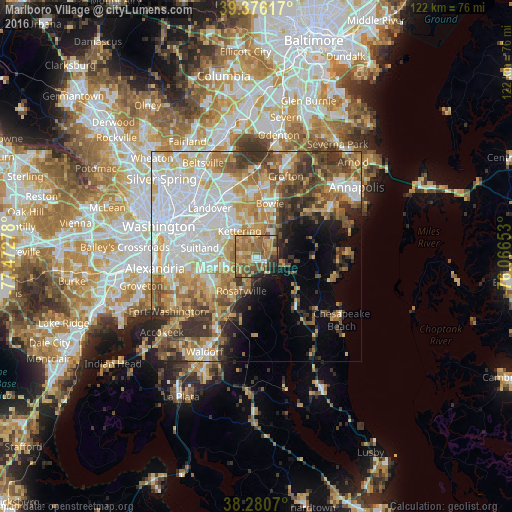
Analysis of Marlboro Village night lights 2016
Square area 10x10 km:
 3.4%
3.4%90-99
3.91%80-89
14.29%70-79
13.1%60-69
21.94%50-59
20.24%40-49
8.5%30-39
6.29%20-29
4.76%10-19
3.57%0-9
0%Square area 50x50 km:
14.37%90-99
9.39%80-89
7.41%70-79
8.04%60-69
7.09%50-59
7.25%40-49
5.76%30-39
6.62%20-29
4.55%10-19
5.51%0-9
24.03%Clear (daylight) street map image can be seen on geolist.org.
Map coordinates:
39° 22' 34.2" North, 77° 28' 22" West
38° 49' 49.9" North, 76° 46' 10.7" West
38° 16' 50.5" North, 76° 3' 59.5" West
Some cities around Marlboro Village sort by population:
• Greater Upper Marlboro
1.9 km =1.2 mi,  86°
86°
• Kettering
7.2 km =4.5 mi,  327°
327°
• Forestville
9.3 km =5.8 mi,  280°
280°
• Largo
9.1 km =5.7 mi,  324°
324°
• Rosaryville
8.9 km =5.5 mi,  202°
202°
• Brock Hall
2.3 km =1.4 mi,  18°
18°
• Marlton
6.6 km =4.1 mi, 195°
• Westphalia
3.9 km =2.4 mi,  294°
294°
7315260 (p: 9,438)
Sources (retrieved 2019-11-25):
» Earth at Night: Flat Maps 2012, 2016