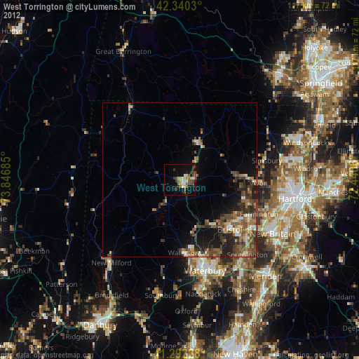
West Torrington night lights from space
Night Light of West Torrington (Connecticut) from space (United States) Src. Average luminocity for 10x10km area is 23.853% and for 50x50km: 10.0722%.
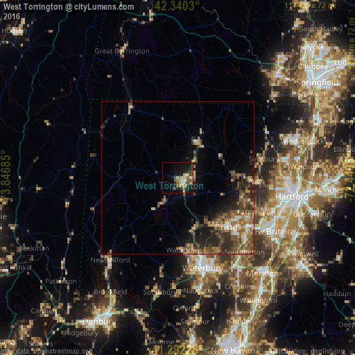
Analysis of West Torrington night lights 2016
Square area 10x10 km:
 1.67%
1.67%90-99
2.88%80-89
3.94%70-79
5%60-69
2.58%50-59
4.39%40-49
4.55%30-39
1.82%20-29
4.39%10-19
24.55%0-9
44.24%Square area 50x50 km:
0.55%90-99
0.71%80-89
1.36%70-79
1.53%60-69
1.78%50-59
2.34%40-49
2.47%30-39
2.23%20-29
3.32%10-19
5.31%0-9
78.39%Clear (daylight) street map image can be seen on geolist.org.
Map coordinates:
42° 20' 25.1" North, 73° 50' 48.7" West
41° 49' 6.3" North, 73° 8' 37.4" West
41° 17' 32.2" North, 72° 26' 26.2" West
Some cities around West Torrington sort by population:
• Bristol
22.9 km =14.2 mi,  135°
135°
• Torrington
2.7 km =1.7 mi, 136°
• Wolcott
27.3 km =17 mi,  151°
151°
• Plymouth
17.9 km =11.1 mi,  155°
155°
• Winchester Center
9.1 km =5.7 mi,  4°
4°
• Oakville
25.5 km =15.8 mi,  169°
169°
• Winsted
13.4 km =8.3 mi,  31°
31°
• Terryville
19.1 km =11.9 mi, 144°
4845519 (p: 36,000)
Sources (retrieved 2019-11-25):
» Earth at Night: Flat Maps 2012, 2016