Torrington night lights from space
Night Light of Torrington (Connecticut) from space (United States) Src. Average luminocity for 10x10km area is 28.2224% and for 50x50km: 12.4054%.
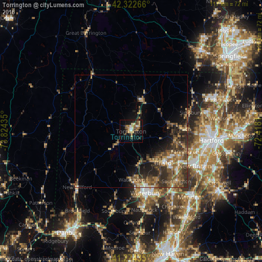
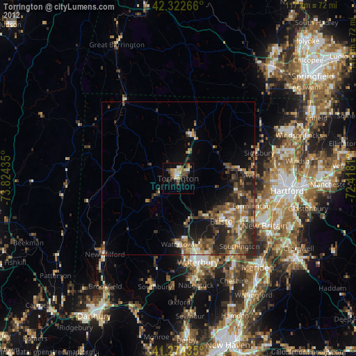
Analysis of Torrington night lights 2016
Square area 10x10 km:
 1.79%
1.79%90-99
3.08%80-89
5.68%70-79
5.84%60-69
2.76%50-59
5.36%40-49
5.84%30-39
1.3%20-29
4.55%10-19
26.46%0-9
37.34%Square area 50x50 km:
0.75%90-99
0.95%80-89
1.84%70-79
1.76%60-69
2.08%50-59
2.87%40-49
3.19%30-39
2.88%20-29
4.09%10-19
5.7%0-9
73.87%Clear (daylight) street map image can be seen on geolist.org.
Map coordinates:
42° 19' 21.6" North, 73° 49' 27.7" West
41° 48' 2.3" North, 73° 7' 16.4" West
41° 16' 27.7" North, 72° 25' 5.2" West
Some cities around Torrington sort by population:
• Bristol
20.2 km =12.6 mi,  135°
135°
• West Torrington
2.7 km =1.7 mi,  316°
316°
• Wolcott
24.7 km =15.3 mi,  153°
153°
• Plymouth
15.4 km =9.6 mi,  158°
158°
• Winchester Center
11.1 km =6.9 mi,  354°
354°
• Oakville
23.2 km =14.4 mi,  172°
172°
• Winsted
14.3 km =8.9 mi,  20°
20°
• Terryville
16.4 km =10.2 mi, 146°
4844309 (p: 34,906)
Sources (retrieved 2019-11-25):
» Earth at Night: Flat Maps 2012, 2016