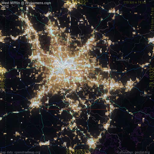
West Mifflin night lights from space
Night Light of West Mifflin (Pennsylvania) from space (United States) Src. Average luminocity for 10x10km area is 78.619% and for 50x50km: 51.5071%.
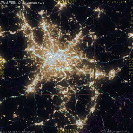
Analysis of West Mifflin night lights 2016
Square area 10x10 km:
 11.56%
90-99
17.86%80-89
14.8%70-79
22.11%60-69
26.02%50-59
6.29%40-49
1.36%30-39
0%20-29
0%10-19
0%0-9
0%Square area 50x50 km:
7.9%90-99
9.23%80-89
6.46%70-79
7.69%60-69
10.44%50-59
10.83%40-49
8.31%30-39
7.06%20-29
10.79%10-19
11.49%0-9
9.79%Clear (daylight) street map image can be seen on geolist.org.
Map coordinates:
40° 53' 49.3" North, 80° 34' 10.5" West
40° 21' 48.2" North, 79° 51' 59.2" West
39° 49' 31.9" North, 79° 9' 48" West
Some cities around West Mifflin sort by population:
• McKeesport
1.7 km =1.1 mi,  173°
173°
• Munhall
4.3 km =2.7 mi,  318°
318°
• North Versailles
5.2 km =3.2 mi,  69°
69°
• White Oak
5.6 km =3.5 mi,  120°
120°
• Wilson
6.3 km =3.9 mi,  199°
199°
• Forest Hills
6.4 km =4 mi,  12°
12°
• Duquesne
2.1 km =1.3 mi,  15°
15°
• Turtle Creek
5.9 km =3.7 mi,  36°
36°
5218802 (p: 20,075)
Sources (retrieved 2019-11-25):
» Earth at Night: Flat Maps 2012, 2016