West Hartford night lights from space
Night Light of West Hartford (Connecticut) from space (United States) Src. Average luminocity for 10x10km area is 79.9773% and for 50x50km: 41.5307%.
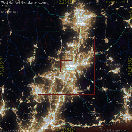
Analysis of West Hartford night lights 2016
Square area 10x10 km:
 24.68%
90-99
21.59%80-89
10.39%70-79
12.18%60-69
12.5%50-59
7.63%40-49
3.9%30-39
4.38%20-29
2.76%10-19
0%0-9
0%Square area 50x50 km:
5.79%90-99
6.19%80-89
6.09%70-79
6.18%60-69
8.3%50-59
8.78%40-49
6.85%30-39
7.95%20-29
9.05%10-19
8.92%0-9
25.9%Clear (daylight) street map image can be seen on geolist.org.
Map coordinates:
42° 17' 3.7" North, 73° 26' 42.6" West
41° 45' 43.3" North, 72° 44' 31.3" West
41° 14' 7.5" North, 72° 2' 20.1" West
Some cities around West Hartford sort by population:
• Hartford
4.7 km =2.9 mi,  87°
87°
• New Britain
11.6 km =7.2 mi,  195°
195°
• East Hartford
11 km =6.8 mi,  78°
78°
• Glastonbury
12.4 km =7.7 mi,  116°
116°
• Newington
7.3 km =4.5 mi,  167°
167°
• Wethersfield
9.1 km =5.7 mi,  125°
125°
• Farmington
8.8 km =5.5 mi,  237°
237°
• South Windsor
12.1 km =7.5 mi,  55°
55°
4845411 (p: 63,268)
Sources (retrieved 2019-11-25):
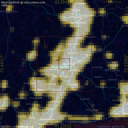
» NASA, Earths city lights 1995
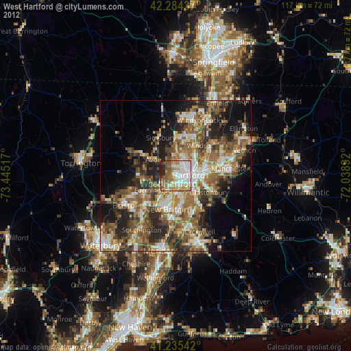
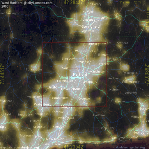
» NASA city lights 2003
» Earth at Night: Flat Maps 2012, 2016