South Lawndale night lights from space
Night Light of South Lawndale (Illinois) from space (United States) Src. Average luminocity for 10x10km area is 100% and for 50x50km: 71.9962%.
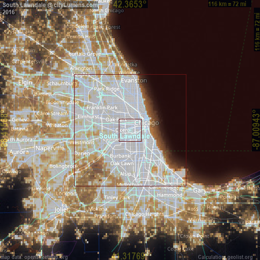
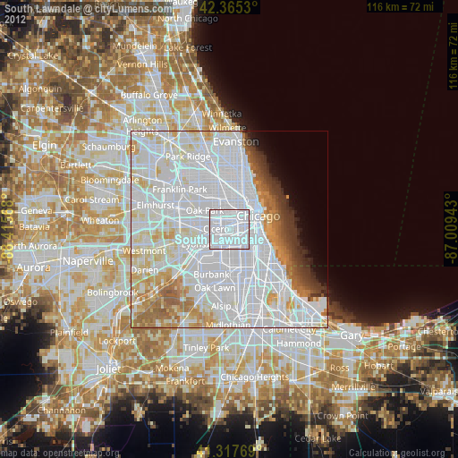
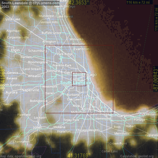
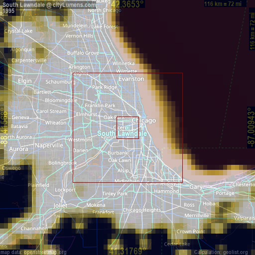
Analysis of South Lawndale night lights 2016
Square area 10x10 km:
 100%
100%90-99
0%80-89
0%70-79
0%60-69
0%50-59
0%40-49
0%30-39
0%20-29
0%10-19
0%0-9
0%Square area 50x50 km:
42.24%90-99
16.81%80-89
5.74%70-79
3.26%60-69
3.14%50-59
2.96%40-49
2.19%30-39
1.62%20-29
1.69%10-19
2.36%0-9
17.99%Clear (daylight) street map image can be seen on geolist.org.
Map coordinates:
42° 21' 55.1" North, 88° 24' 56.4" West
41° 50' 37.1" North, 87° 42' 45.2" West
41° 19' 3.7" North, 87° 0' 33.9" West
Some cities around South Lawndale sort by population:
• Cicero
3.4 km =2.1 mi,  273°
273°
• Brighton Park
3 km =1.9 mi,  157°
157°
• North Lawndale
1.9 km =1.2 mi,  345°
345°
• Lower West Side
4.1 km =2.5 mi,  73°
73°
• Bridgeport
5.1 km =3.2 mi,  96°
96°
• East Garfield Park
4.2 km =2.6 mi,  11°
11°
• West Garfield Park
4.3 km =2.7 mi,  341°
341°
• McKinley Park
3.5 km =2.2 mi,  112°
112°
4911951 (p: 73,826)
Sources (retrieved 2019-11-25):
» NASA, Earths city lights 1995
» NASA city lights 2003
» Earth at Night: Flat Maps 2012, 2016