Stickney night lights from space
Night Light of Stickney (Illinois) from space (United States) Src. Average luminocity for 10x10km area is 99.3636% and for 50x50km: 81.905%.
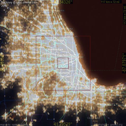
Analysis of Stickney night lights 2016
Square area 10x10 km:
 82.58%
90-99
16.21%80-89
1.21%70-79
0%60-69
0%50-59
0%40-49
0%30-39
0%20-29
0%10-19
0%0-9
0%Square area 50x50 km:
45.29%90-99
20.05%80-89
7.81%70-79
5.33%60-69
3.96%50-59
3.47%40-49
1.99%30-39
1.38%20-29
1.29%10-19
1.67%0-9
7.74%Clear (daylight) street map image can be seen on geolist.org.
Map coordinates:
42° 20' 35.7" North, 88° 29' 9.5" West
41° 49' 17.1" North, 87° 46' 58.2" West
41° 17' 43" North, 87° 4' 47" West
Some cities around Stickney sort by population:
• Cicero
3.6 km =2.2 mi,  41°
41°
• Berwyn
3.4 km =2.1 mi,  344°
344°
• West Elsdon
5.7 km =3.5 mi,  122°
122°
• Brookfield
5.7 km =3.5 mi,  272°
272°
• Summit
4.4 km =2.7 mi,  211°
211°
• Lyons
3.1 km =1.9 mi,  252°
252°
• Riverside
3.6 km =2.2 mi,  294°
294°
• North Riverside
4.1 km =2.5 mi,  305°
305°
4912555 (p: 6,786)
Sources (retrieved 2019-11-25):
» Earth at Night: Flat Maps 2012, 2016