West Bridgewater night lights from space
Night Light of West Bridgewater (Massachusetts) from space (United States) Src. Average luminocity for 10x10km area is 54.2492% and for 50x50km: 38.6239%.
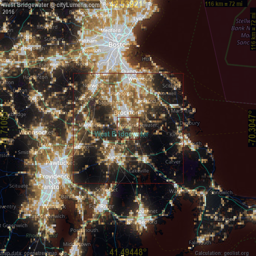
Analysis of West Bridgewater night lights 2016
Square area 10x10 km:
 4.76%
4.76%90-99
5.24%80-89
8.73%70-79
5.4%60-69
8.41%50-59
21.11%40-49
18.89%30-39
8.41%20-29
19.05%10-19
0%0-9
0%Square area 50x50 km:
4.32%90-99
5.9%80-89
4.25%70-79
4.13%60-69
6.99%50-59
8.56%40-49
8.55%30-39
8.09%20-29
12.81%10-19
16.51%0-9
19.88%Clear (daylight) street map image can be seen on geolist.org.
Map coordinates:
42° 32' 21.2" North, 71° 42' 39.4" West
42° 1' 8.4" North, 71° 0' 28.2" West
41° 29' 40.1" North, 70° 18' 16.9" West
Some cities around West Bridgewater sort by population:
• Brockton
7.2 km =4.5 mi,  353°
353°
• Easton
10 km =6.2 mi,  273°
273°
• Abington
10.8 km =6.7 mi,  28°
28°
• Whitman
9.1 km =5.7 mi,  41°
41°
• East Bridgewater
4.3 km =2.7 mi,  68°
68°
• Raynham
9.5 km =5.9 mi,  214°
214°
• Bridgewater
4.2 km =2.6 mi,  139°
139°
• Halifax
12.4 km =7.7 mi,  104°
104°
4954886 (p: 6,750)
Sources (retrieved 2019-11-25):
» Earth at Night: Flat Maps 2012, 2016