Welby night lights from space
Night Light of Welby (Colorado) from space (United States) Src. Average luminocity for 10x10km area is 93.1684% and for 50x50km: 63.1061%.
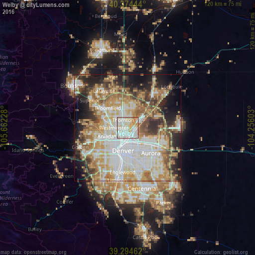
Analysis of Welby night lights 2016
Square area 10x10 km:
 39.63%
90-99
33.67%80-89
13.1%70-79
10.88%60-69
2.72%50-59
0%40-49
0%30-39
0%20-29
0%10-19
0%0-9
0%Square area 50x50 km:
16.97%90-99
13.77%80-89
9.15%70-79
10.85%60-69
7.96%50-59
6.83%40-49
6.02%30-39
5.55%20-29
8%10-19
9.24%0-9
5.65%Clear (daylight) street map image can be seen on geolist.org.
Map coordinates:
40° 22' 28" North, 105° 39' 44.2" West
39° 50' 11.9" North, 104° 57' 32.9" West
39° 17' 40.6" North, 104° 15' 21.7" West
Some cities around Welby sort by population:
• Thornton
3.7 km =2.3 mi,  342°
342°
• Commerce City
3.8 km =2.4 mi,  145°
145°
• Northglenn
5.9 km =3.7 mi, 336°
• Sherrelwood
3.6 km =2.2 mi,  271°
271°
• Federal Heights
3.7 km =2.3 mi,  295°
295°
• Berkley
6.7 km =4.2 mi,  237°
237°
• Derby
3.5 km =2.2 mi,  84°
84°
• Twin Lakes
4.1 km =2.5 mi,  251°
251°
5443482 (p: 14,846)
Sources (retrieved 2019-11-25):
» Earth at Night: Flat Maps 2012, 2016