Derby night lights from space
Night Light of Derby (Colorado) from space (United States) Src. Average luminocity for 10x10km area is 82.4779% and for 50x50km: 61.0949%.
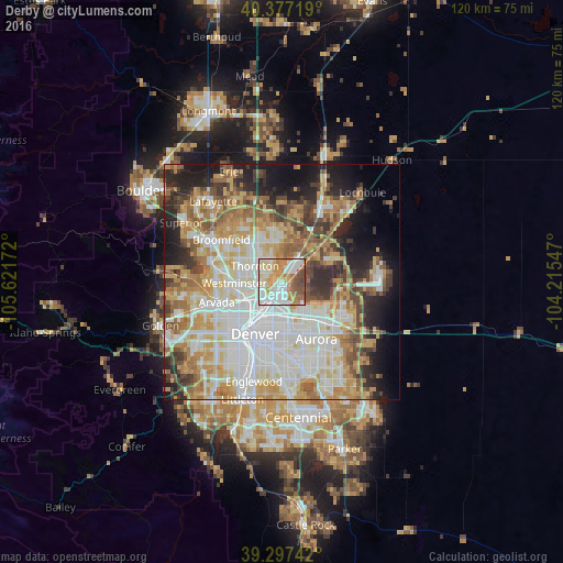
Analysis of Derby night lights 2016
Square area 10x10 km:
 24.32%
90-99
23.3%80-89
11.73%70-79
14.8%60-69
10.37%50-59
9.18%40-49
6.29%30-39
0%20-29
0%10-19
0%0-9
0%Square area 50x50 km:
16.62%90-99
13.39%80-89
8.79%70-79
10.39%60-69
7.76%50-59
6.59%40-49
5.71%30-39
5.24%20-29
7.2%10-19
9.15%0-9
9.15%Clear (daylight) street map image can be seen on geolist.org.
Map coordinates:
40° 22' 37.9" North, 105° 37' 18.2" West
39° 50' 21.9" North, 104° 55' 6.9" West
39° 17' 50.7" North, 104° 12' 55.7" West
Some cities around Derby sort by population:
• Thornton
5.6 km =3.5 mi,  304°
304°
• Commerce City
3.7 km =2.3 mi,  200°
200°
• Northglenn
7.8 km =4.8 mi,  311°
311°
• Sherrelwood
7.1 km =4.4 mi,  268°
268°
• Welby
3.5 km =2.2 mi,  264°
264°
• Federal Heights
7 km =4.3 mi,  281°
281°
• Berkley
10 km =6.2 mi,  247°
247°
• Twin Lakes
7.5 km =4.7 mi, 257°
5419431 (p: 7,685)
Sources (retrieved 2019-11-25):
» Earth at Night: Flat Maps 2012, 2016