Thornton night lights from space
Night Light of Thornton (Colorado) from space (United States) Src. Average luminocity for 10x10km area is 91.0578% and for 50x50km: 60.1661%.
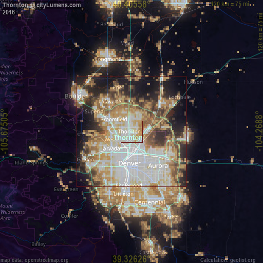
Analysis of Thornton night lights 2016
Square area 10x10 km:
 27.72%
90-99
34.86%80-89
19.9%70-79
13.61%60-69
3.91%50-59
0%40-49
0%30-39
0%20-29
0%10-19
0%0-9
0%Square area 50x50 km:
16.3%90-99
13.11%80-89
8.4%70-79
9.57%60-69
7.16%50-59
6.8%40-49
6.13%30-39
5.53%20-29
8.08%10-19
11.88%0-9
7.06%Clear (daylight) street map image can be seen on geolist.org.
Map coordinates:
40° 24' 20.1" North, 105° 40' 30.2" West
39° 52' 4.9" North, 104° 58' 18.9" West
39° 19' 34.5" North, 104° 16' 7.7" West
Some cities around Thornton sort by population:
• Westminster
6.6 km =4.1 mi,  237°
237°
• Northglenn
2.3 km =1.4 mi,  326°
326°
• Sherrelwood
4.2 km =2.6 mi,  216°
216°
• Welby
3.7 km =2.3 mi,  162°
162°
• Federal Heights
2.9 km =1.8 mi,  230°
230°
• Derby
5.6 km =3.5 mi,  124°
124°
• Twin Lakes
5.5 km =3.4 mi,  210°
210°
• Shaw Heights
6.3 km =3.9 mi,  254°
254°
5441492 (p: 133,451)
Sources (retrieved 2019-11-25):
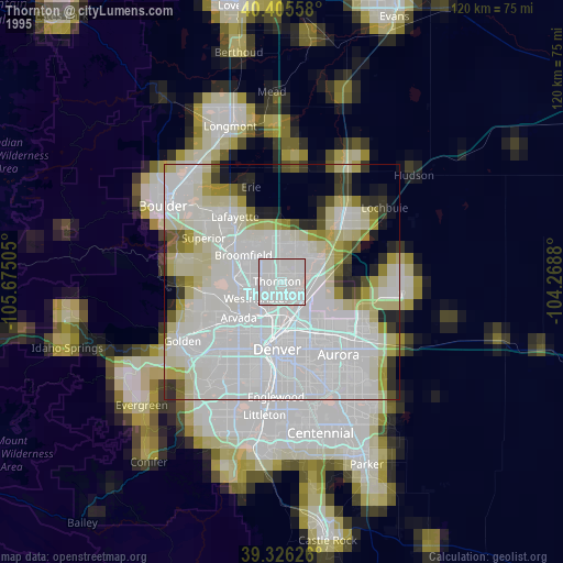
» NASA, Earths city lights 1995
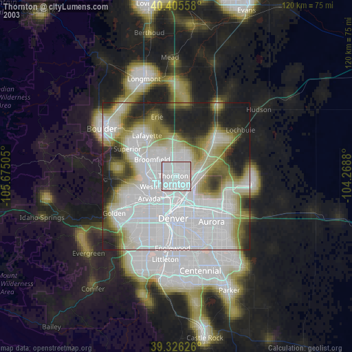
» NASA city lights 2003
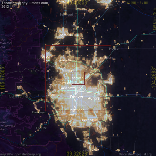
» Earth at Night: Flat Maps 2012, 2016