Waupun night lights from space
Night Light of Waupun (Wisconsin) from space (United States) Src. Average luminocity for 10x10km area is 14.3152% and for 50x50km: 6.6945%.
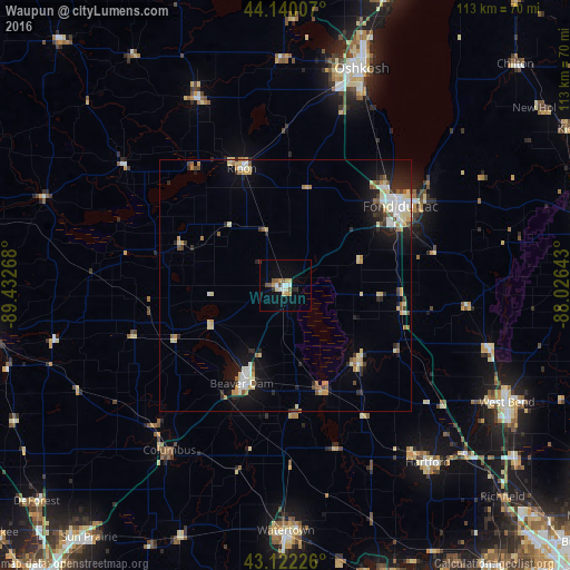
Analysis of Waupun night lights 2016
Square area 10x10 km:
 2.12%
2.12%90-99
2.12%80-89
2.42%70-79
1.82%60-69
0.61%50-59
2.88%40-49
1.36%30-39
0.61%20-29
1.52%10-19
3.48%0-9
81.06%Square area 50x50 km:
0.86%90-99
1.02%80-89
1.33%70-79
0.76%60-69
0.75%50-59
0.68%40-49
0.61%30-39
0.56%20-29
1.64%10-19
3.44%0-9
88.35%Clear (daylight) street map image can be seen on geolist.org.
Map coordinates:
44° 8' 24.3" North, 89° 25' 57.6" West
43° 37' 60" North, 88° 43' 46.4" West
43° 7' 20.1" North, 88° 1' 35.1" West
Some cities around Waupun sort by population:
• Oshkosh
46 km =28.6 mi,  19°
19°
• Fond du Lac
28.2 km =17.5 mi,  56°
56°
• Watertown
48.8 km =30.3 mi,  179°
179°
• Beaver Dam
21.4 km =13.3 mi,  203°
203°
• Hartford
45.1 km =28 mi,  141°
141°
• Ripon
24.7 km =15.3 mi,  339°
339°
• Berlin
41 km =25.5 mi, 335°
• North Fond du Lac
28 km =17.4 mi,  44°
44°
5278106 (p: 11,343)
Sources (retrieved 2019-11-25):
» Earth at Night: Flat Maps 2012, 2016