Vienna night lights from space
Night Light of Vienna (West Virginia) from space (United States) Src. Average luminocity for 10x10km area is 40.9473% and for 50x50km: 9.8508%.
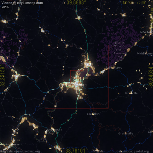
Analysis of Vienna night lights 2016
Square area 10x10 km:
 4.25%
4.25%90-99
5.61%80-89
4.42%70-79
7.48%60-69
7.99%50-59
4.25%40-49
5.95%30-39
10.71%20-29
21.43%10-19
18.88%0-9
9.01%Square area 50x50 km:
0.96%90-99
1.47%80-89
1.05%70-79
1.48%60-69
1.3%50-59
1.28%40-49
1.63%30-39
1.72%20-29
3.42%10-19
7.26%0-9
78.42%Clear (daylight) street map image can be seen on geolist.org.
Map coordinates:
39° 52' 7.7" North, 82° 15' 5.7" West
39° 19' 37.3" North, 81° 32' 54.5" West
38° 46' 51.6" North, 80° 50' 43.2" West
Some cities around Vienna sort by population:
• Parkersburg
6.8 km =4.2 mi,  189°
189°
• Athens
47.5 km =29.5 mi,  270°
270°
• Marietta
12.7 km =7.9 mi,  39°
39°
• Cambridge
78.4 km =48.7 mi,  357°
357°
• Logan
77.5 km =48.2 mi,  287°
287°
• Belpre
6.3 km =3.9 mi,  199°
199°
• New Martinsville
69 km =42.9 mi,  59°
59°
• Nelsonville
60.5 km =37.6 mi,  283°
283°
4825976 (p: 10,573)
Sources (retrieved 2019-11-25):
» Earth at Night: Flat Maps 2012, 2016