Logan night lights from space
Night Light of Logan (Ohio) from space (United States) Src. Average luminocity for 10x10km area is 16.2955% and for 50x50km: 5.314%.
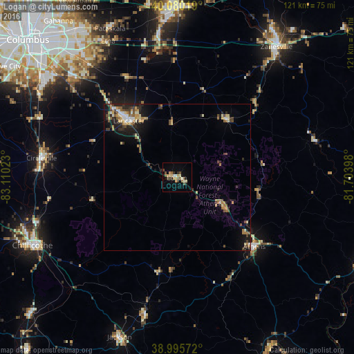
Analysis of Logan night lights 2016
Square area 10x10 km:
 0.65%
0.65%90-99
2.44%80-89
2.11%70-79
3.08%60-69
1.95%50-59
2.76%40-49
3.9%30-39
1.79%20-29
1.3%10-19
4.87%0-9
75.16%Square area 50x50 km:
0.36%90-99
0.65%80-89
0.83%70-79
0.67%60-69
0.89%50-59
0.69%40-49
0.97%30-39
0.84%20-29
1.48%10-19
2.81%0-9
89.81%Clear (daylight) street map image can be seen on geolist.org.
Map coordinates:
40° 4' 48.7" North, 83° 6' 36.8" West
39° 32' 24.3" North, 82° 24' 25.6" West
38° 59' 44.6" North, 81° 42' 14.3" West
Some cities around Logan sort by population:
• Lancaster
25.4 km =15.8 mi,  319°
319°
• Athens
35.2 km =21.9 mi,  131°
131°
• Pickerington
48.4 km =30.1 mi, 322°
• Circleville
46.7 km =29 mi,  278°
278°
• Canal Winchester
47.9 km =29.8 mi,  314°
314°
• Geneva
13.7 km =8.5 mi,  350°
350°
• Wellston
47.6 km =29.6 mi,  193°
193°
• Nelsonville
17.6 km =10.9 mi,  121°
121°
4516989 (p: 7,117)
Sources (retrieved 2019-11-25):
» Earth at Night: Flat Maps 2012, 2016