Valencia night lights from space
Night Light of Valencia (California) from space (United States) Src. Average luminocity for 10x10km area is 65.3829% and for 50x50km: 26.6402%.
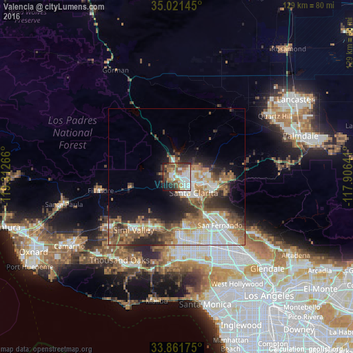
Analysis of Valencia night lights 2016
Square area 10x10 km:
 15.38%
90-99
15.73%80-89
7.34%70-79
6.64%60-69
11.19%50-59
11.19%40-49
9.27%30-39
9.44%20-29
8.92%10-19
4.72%0-9
0.17%Square area 50x50 km:
4.85%90-99
5.68%80-89
2.57%70-79
3.01%60-69
5.53%50-59
4.41%40-49
3.87%30-39
3.88%20-29
5.23%10-19
7.04%0-9
53.94%Clear (daylight) street map image can be seen on geolist.org.
Map coordinates:
35° 1' 17.2" North, 119° 18' 45.6" West
34° 26' 37" North, 118° 36' 34.3" West
33° 51' 42.3" North, 117° 54' 23.1" West
Some cities around Valencia sort by population:
• Santa Clarita
8.4 km =5.2 mi,  133°
133°
• Simi Valley
25 km =15.5 mi,  219°
219°
• Northridge
24.9 km =15.5 mi,  164°
164°
• North Hills
25.7 km =16 mi,  153°
153°
• Chatsworth
20.7 km =12.9 mi,  177°
177°
• San Fernando
23.8 km =14.8 mi,  138°
138°
• Castaic
5.2 km =3.2 mi,  346°
346°
• Stevenson Ranch
6.8 km =4.2 mi, 150°
5405288 (p: 148,456)
Sources (retrieved 2019-11-25):
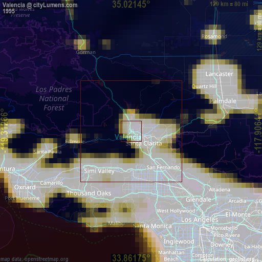
» NASA, Earths city lights 1995
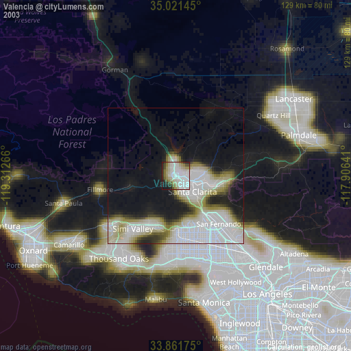
» NASA city lights 2003
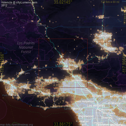
» Earth at Night: Flat Maps 2012, 2016