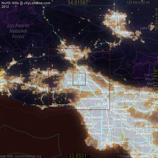
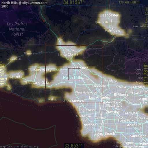
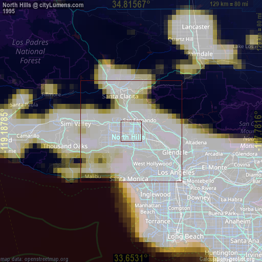
North Hills night lights from space
Night Light of North Hills (California) from space (United States) Src. Average luminocity for 10x10km area is 96.0989% and for 50x50km: 55.7865%.
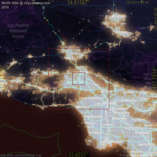
Analysis of North Hills night lights 2016
Square area 10x10 km:
 41.03%
90-99
40.84%80-89
15.93%70-79
2.2%60-69
0%50-59
0%40-49
0%30-39
0%20-29
0%10-19
0%0-9
0%Square area 50x50 km:
19.23%90-99
11.66%80-89
4.91%70-79
6.64%60-69
9.19%50-59
5.85%40-49
4.65%30-39
4.58%20-29
6.99%10-19
8.54%0-9
17.76%Clear (daylight) street map image can be seen on geolist.org.
Map coordinates:
34° 48' 56.4" North, 119° 11' 16.3" West
34° 14' 11" North, 118° 29' 5" West
33° 39' 11.2" North, 117° 46' 53.8" West
Some cities around North Hills sort by population:
• Van Nuys
6.4 km =4 mi,  149°
149°
• Canoga Park
11.1 km =6.9 mi,  249°
249°
• Valley Glen
6.1 km =3.8 mi, 147°
• Sherman Oaks
10 km =6.2 mi,  161°
161°
• Encino
8.7 km =5.4 mi,  190°
190°
• Chatsworth
11 km =6.8 mi,  282°
282°
• San Fernando
6.6 km =4.1 mi,  39°
39°
• Shadow Hills
12.5 km =7.8 mi,  76°
76°
5394409 (p: 56,946)
Sources (retrieved 2019-11-25):
» NASA, Earths city lights 1995
» NASA city lights 2003
» Earth at Night: Flat Maps 2012, 2016