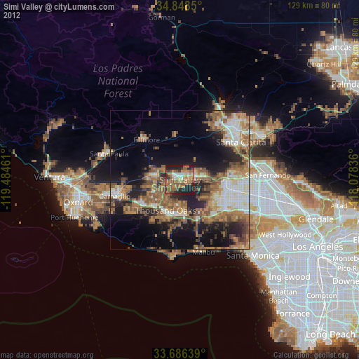
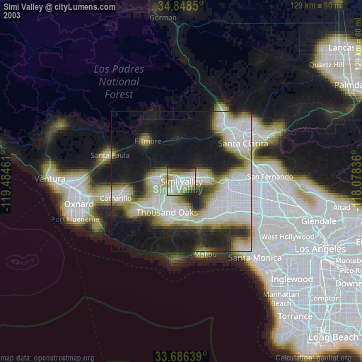
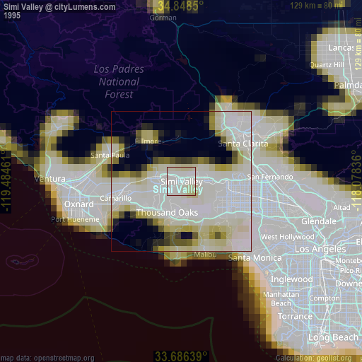
Simi Valley night lights from space
Night Light of Simi Valley (California) from space (United States) Src. Average luminocity for 10x10km area is 54.2161% and for 50x50km: 33.2111%.
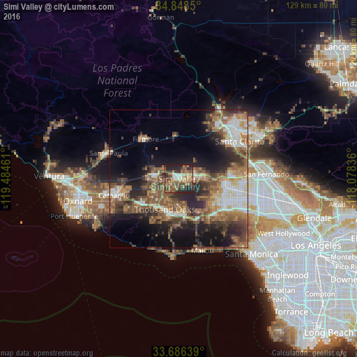
Analysis of Simi Valley night lights 2016
Square area 10x10 km:
 6.23%
6.23%90-99
5.31%80-89
3.66%70-79
9.52%60-69
18.32%50-59
12.64%40-49
12.09%30-39
9.71%20-29
19.05%10-19
3.48%0-9
0%Square area 50x50 km:
4.49%90-99
4.97%80-89
2.88%70-79
3.94%60-69
8.03%50-59
6.84%40-49
6.65%30-39
6.11%20-29
8.63%10-19
11.72%0-9
35.72%Clear (daylight) street map image can be seen on geolist.org.
Map coordinates:
34° 50' 54.6" North, 119° 29' 4.6" West
34° 16' 10" North, 118° 46' 53.3" West
33° 41' 11" North, 118° 4' 42.1" West
Some cities around Simi Valley sort by population:
• Thousand Oaks
12.1 km =7.5 mi,  205°
205°
• West Hills
15 km =9.3 mi,  122°
122°
• Chatsworth
16.6 km =10.3 mi,  94°
94°
• Moorpark
9.4 km =5.8 mi,  280°
280°
• Agoura Hills
14.8 km =9.2 mi,  177°
177°
• Agoura
14.6 km =9.1 mi,  164°
164°
• Oak Park
10.2 km =6.3 mi,  170°
170°
• Westlake Village
13.9 km =8.6 mi,  189°
189°
5396003 (p: 126,788)
Sources (retrieved 2019-11-25):
» NASA, Earths city lights 1995
» NASA city lights 2003
» Earth at Night: Flat Maps 2012, 2016