Union City night lights from space
Night Light of Union City (California) from space (United States) Src. Average luminocity for 10x10km area is 66.0867% and for 50x50km: 43.8611%.
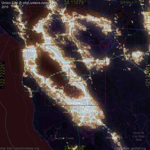

Analysis of Union City night lights 2016
Square area 10x10 km:
 16.33%
90-99
14.97%80-89
9.01%70-79
14.46%60-69
9.86%50-59
5.27%40-49
4.08%30-39
4.93%20-29
11.22%10-19
9.01%0-9
0.85%Square area 50x50 km:
11.47%90-99
9.62%80-89
2.54%70-79
4.95%60-69
6.07%50-59
7.04%40-49
5.09%30-39
4.67%20-29
10.96%10-19
15.76%0-9
21.83%Clear (daylight) street map image can be seen on geolist.org.
Map coordinates:
38° 9' 2.8" North, 122° 43' 20.1" West
37° 35' 44.8" North, 122° 1' 8.9" West
37° 2' 11.7" North, 121° 18' 57.6" West
Some cities around Union City sort by population:
• Fremont
5.9 km =3.7 mi,  152°
152°
• Hayward
9.8 km =6.1 mi,  326°
326°
• Castro Valley
12.4 km =7.7 mi, 331°
• Newark
7.6 km =4.7 mi,  194°
194°
• San Lorenzo
13.3 km =8.3 mi,  315°
315°
• Ashland
13.8 km =8.6 mi, 322°
• Cherryland
11.9 km =7.4 mi, 321°
• Fairview
9.5 km =5.9 mi,  345°
345°
5404555 (p: 74,494)
Sources (retrieved 2019-11-25):
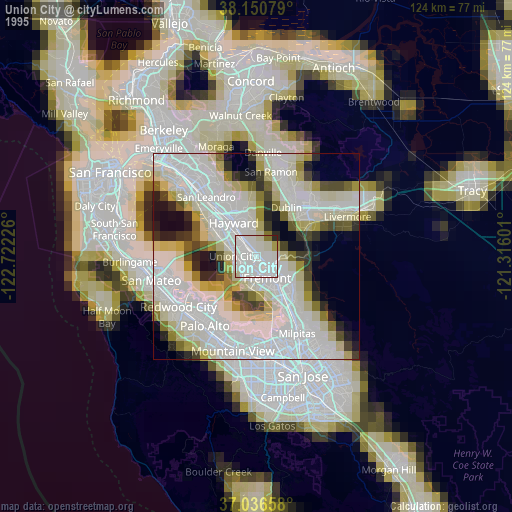
» NASA, Earths city lights 1995
» NASA city lights 2003
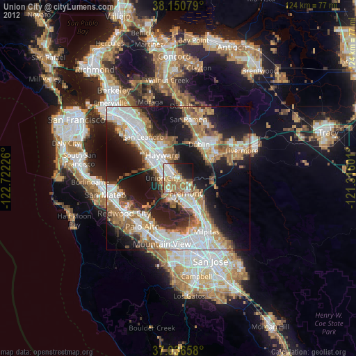
» Earth at Night: Flat Maps 2012, 2016