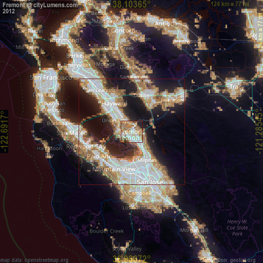
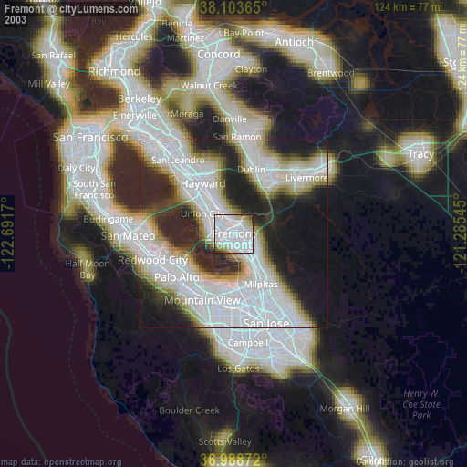
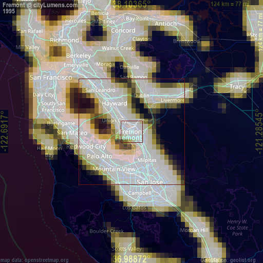
Fremont night lights from space
Night Light of Fremont (California) from space (United States) Src. Average luminocity for 10x10km area is 77.0049% and for 50x50km: 45.0598%.
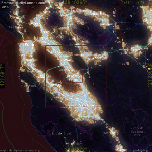
Analysis of Fremont night lights 2016
Square area 10x10 km:
 19.64%
90-99
22.73%80-89
11.53%70-79
15.26%60-69
9.74%50-59
6.17%40-49
4.22%30-39
2.44%20-29
6.49%10-19
1.79%0-9
0%Square area 50x50 km:
12.47%90-99
10.44%80-89
2.76%70-79
5.36%60-69
5.96%50-59
6.43%40-49
4.63%30-39
4.45%20-29
10.1%10-19
15.03%0-9
22.39%Clear (daylight) street map image can be seen on geolist.org.
Map coordinates:
38° 6' 13.1" North, 122° 41' 30.1" West
37° 32' 53.8" North, 121° 59' 18.9" West
36° 59' 19.4" North, 121° 17' 7.6" West
Some cities around Fremont sort by population:
• Hayward
15.7 km =9.8 mi,  328°
328°
• Pleasanton
16.2 km =10.1 mi,  38°
38°
• Milpitas
15.2 km =9.4 mi,  151°
151°
• Union City
5.9 km =3.7 mi, 332°
• Dublin
17.7 km =11 mi,  15°
15°
• Newark
5 km =3.1 mi,  245°
245°
• East Palo Alto
16.1 km =10 mi,  236°
236°
• Fairview
15.3 km =9.5 mi,  340°
340°
5350734 (p: 232,206)
Sources (retrieved 2019-11-25):
» NASA, Earths city lights 1995
» NASA city lights 2003
» Earth at Night: Flat Maps 2012, 2016