Castro Valley night lights from space
Night Light of Castro Valley (California) from space (United States) Src. Average luminocity for 10x10km area is 71.6378% and for 50x50km: 41.9232%.
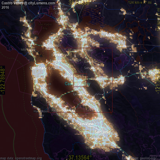
Analysis of Castro Valley night lights 2016
Square area 10x10 km:
 17.01%
90-99
23.81%80-89
2.04%70-79
9.52%60-69
12.59%50-59
14.46%40-49
8.67%30-39
3.23%20-29
5.78%10-19
2.89%0-9
0%Square area 50x50 km:
8.84%90-99
8.64%80-89
2.45%70-79
4.51%60-69
5.72%50-59
7.53%40-49
6.94%30-39
5.86%20-29
13.08%10-19
17.41%0-9
19.01%Clear (daylight) street map image can be seen on geolist.org.
Map coordinates:
38° 14' 54.2" North, 122° 47' 22.1" West
37° 41' 38.8" North, 122° 5' 10.9" West
37° 8' 8.3" North, 121° 22' 59.6" West
Some cities around Castro Valley sort by population:
• Hayward
2.9 km =1.8 mi,  170°
170°
• San Leandro
7 km =4.3 mi,  299°
299°
• Union City
12.4 km =7.7 mi,  151°
151°
• Dublin
13.3 km =8.3 mi,  86°
86°
• San Lorenzo
3.7 km =2.3 mi,  246°
246°
• Ashland
2.4 km =1.5 mi,  271°
271°
• Cherryland
2.2 km =1.4 mi,  222°
222°
• Fairview
4 km =2.5 mi,  115°
115°
5334928 (p: 61,388)
Sources (retrieved 2019-11-25):
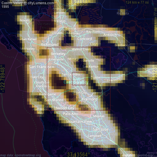
» NASA, Earths city lights 1995
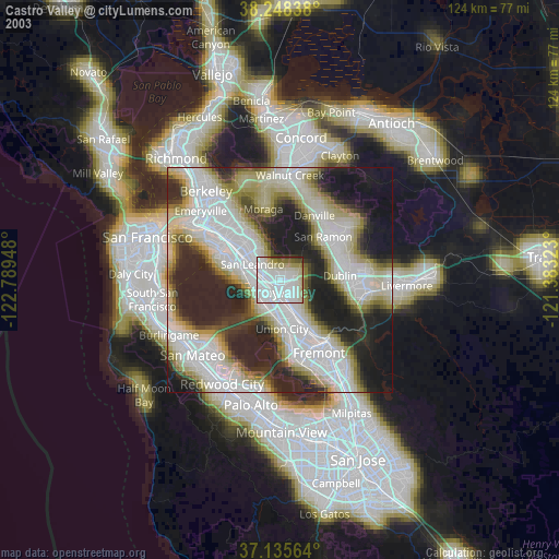
» NASA city lights 2003
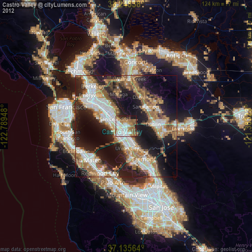
» Earth at Night: Flat Maps 2012, 2016