Hayward night lights from space
Night Light of Hayward (California) from space (United States) Src. Average luminocity for 10x10km area is 81.5799% and for 50x50km: 42.2281%.
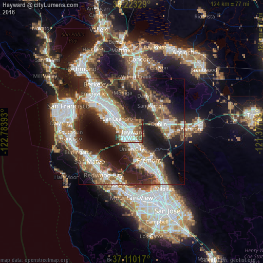

Analysis of Hayward night lights 2016
Square area 10x10 km:
 26.19%
90-99
30.61%80-89
3.4%70-79
6.8%60-69
11.73%50-59
11.56%40-49
5.78%30-39
2.55%20-29
1.36%10-19
0%0-9
0%Square area 50x50 km:
8.95%90-99
8.76%80-89
2.49%70-79
4.62%60-69
5.92%50-59
7.33%40-49
6.87%30-39
5.81%20-29
13.27%10-19
17.15%0-9
18.84%Clear (daylight) street map image can be seen on geolist.org.
Map coordinates:
38° 13' 23.8" North, 122° 47' 2.1" West
37° 40' 7.8" North, 122° 4' 50.9" West
37° 6' 36.6" North, 121° 22' 39.6" West
Some cities around Hayward sort by population:
• San Leandro
9.1 km =5.7 mi,  313°
313°
• Union City
9.8 km =6.1 mi,  146°
146°
• Castro Valley
2.9 km =1.8 mi,  350°
350°
• Dublin
13.3 km =8.3 mi,  73°
73°
• San Lorenzo
4.1 km =2.5 mi,  289°
289°
• Ashland
4.1 km =2.5 mi, 314°
• Cherryland
2.3 km =1.4 mi,  300°
300°
• Fairview
3.3 km =2.1 mi, 70°
5355933 (p: 158,289)
Sources (retrieved 2019-11-25):
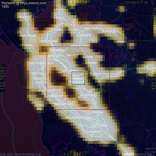
» NASA, Earths city lights 1995
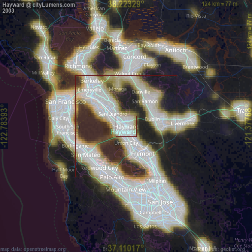
» NASA city lights 2003
» Earth at Night: Flat Maps 2012, 2016