Cherryland night lights from space
Night Light of Cherryland (California) from space (United States) Src. Average luminocity for 10x10km area is 84.619% and for 50x50km: 43.4021%.
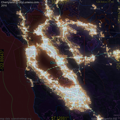
Analysis of Cherryland night lights 2016
Square area 10x10 km:
 25.85%
90-99
34.52%80-89
4.76%70-79
10.37%60-69
11.22%50-59
8.16%40-49
1.87%30-39
1.7%20-29
1.53%10-19
0%0-9
0%Square area 50x50 km:
9.17%90-99
8.89%80-89
2.54%70-79
4.82%60-69
5.99%50-59
7.77%40-49
7.13%30-39
6.05%20-29
13.67%10-19
17.5%0-9
16.46%Clear (daylight) street map image can be seen on geolist.org.
Map coordinates:
38° 14' 1.6" North, 122° 48' 23.1" West
37° 40' 45.8" North, 122° 6' 11.9" West
37° 7' 14.9" North, 121° 24' 0.6" West
Some cities around Cherryland sort by population:
• Hayward
2.3 km =1.4 mi,  120°
120°
• San Leandro
6.9 km =4.3 mi,  317°
317°
• Union City
11.9 km =7.4 mi,  141°
141°
• Castro Valley
2.2 km =1.4 mi,  42°
42°
• Dublin
15 km =9.3 mi,  80°
80°
• San Lorenzo
1.9 km =1.2 mi,  275°
275°
• Ashland
1.9 km =1.2 mi,  331°
331°
• Fairview
5.1 km =3.2 mi,  91°
91°
5336190 (p: 14,728)
Sources (retrieved 2019-11-25):
» Earth at Night: Flat Maps 2012, 2016