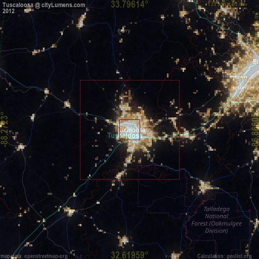
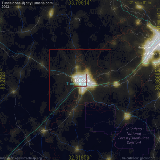
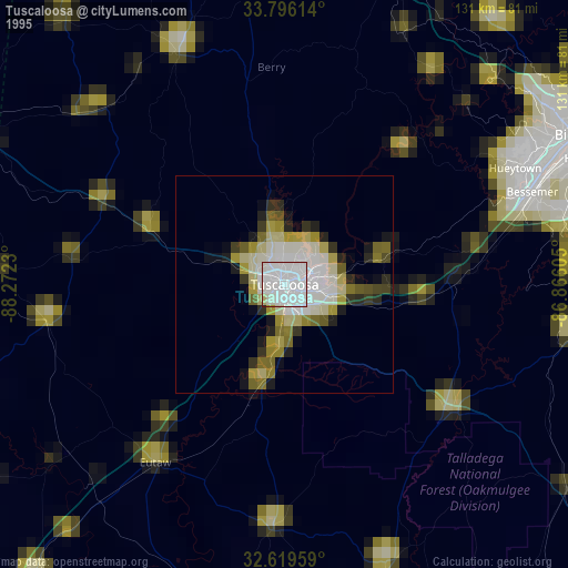
Tuscaloosa night lights from space
Night Light of Tuscaloosa (Alabama) from space (United States) Src. Average luminocity for 10x10km area is 89.4528% and for 50x50km: 15.0834%.

Analysis of Tuscaloosa night lights 2016
Square area 10x10 km:
 37.24%
90-99
29.2%80-89
12.59%70-79
8.22%60-69
5.77%50-59
4.02%40-49
0.87%30-39
2.1%20-29
0%10-19
0%0-9
0%Square area 50x50 km:
2.17%90-99
1.92%80-89
2.47%70-79
1.99%60-69
2.83%50-59
1.94%40-49
2.15%30-39
2.41%20-29
3.8%10-19
7.74%0-9
70.56%Clear (daylight) street map image can be seen on geolist.org.
Map coordinates:
33° 47' 46.1" North, 88° 16' 20.3" West
33° 12' 35.4" North, 87° 34' 9" West
32° 37' 10.5" North, 86° 51' 57.8" West
Some cities around Tuscaloosa sort by population:
• Bessemer
61 km =37.9 mi,  69°
69°
• Northport
2.3 km =1.4 mi,  340°
340°
• Helena
68.1 km =42.3 mi,  81°
81°
• Hueytown
59.6 km =37 mi,  63°
63°
• Fairfield
68.3 km =42.4 mi, 63°
• Pleasant Grove
63.8 km =39.6 mi, 60°
• Montevallo
66.7 km =41.4 mi,  100°
100°
• Midfield
67.4 km =41.9 mi, 65°
4094455 (p: 98,332)
Sources (retrieved 2019-11-25):
» NASA, Earths city lights 1995
» NASA city lights 2003
» Earth at Night: Flat Maps 2012, 2016