Midfield night lights from space
Night Light of Midfield (Alabama) from space (United States) Src. Average luminocity for 10x10km area is 91.764% and for 50x50km: 47.841%.
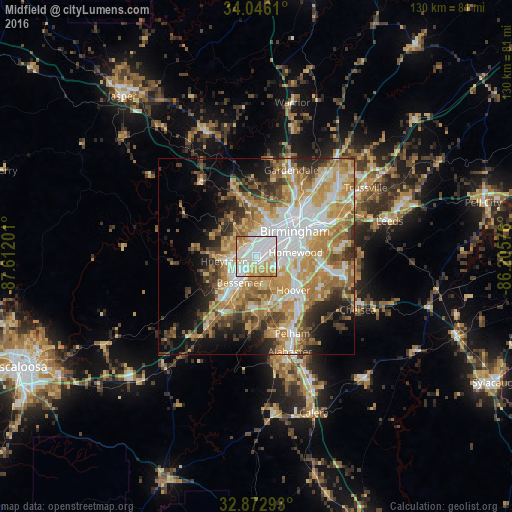
Analysis of Midfield night lights 2016
Square area 10x10 km:
 40.21%
90-99
28.15%80-89
14.16%70-79
12.24%60-69
5.24%50-59
0%40-49
0%30-39
0%20-29
0%10-19
0%0-9
0%Square area 50x50 km:
10.14%90-99
8.25%80-89
7.5%70-79
9.81%60-69
8.95%50-59
4.84%40-49
5.21%30-39
5.75%20-29
6.21%10-19
8.09%0-9
25.24%Clear (daylight) street map image can be seen on geolist.org.
Map coordinates:
34° 2' 46" North, 87° 36' 43.2" West
33° 27' 41.4" North, 86° 54' 32" West
32° 52' 22.5" North, 86° 12' 20.7" West
Some cities around Midfield sort by population:
• Birmingham
11.9 km =7.4 mi,  56°
56°
• Hoover
11 km =6.8 mi,  124°
124°
• Vestavia Hills
11.3 km =7 mi,  97°
97°
• Bessemer
7.9 km =4.9 mi,  212°
212°
• Homewood
10.1 km =6.3 mi,  83°
83°
• Hueytown
8.2 km =5.1 mi,  262°
262°
• Fairfield
2.7 km =1.7 mi,  354°
354°
• Pleasant Grove
6.6 km =4.1 mi,  299°
299°
4075977 (p: 5,222)
Sources (retrieved 2019-11-25):
» Earth at Night: Flat Maps 2012, 2016