Helena night lights from space
Night Light of Helena (Alabama) from space (United States) Src. Average luminocity for 10x10km area is 66.1871% and for 50x50km: 38.6744%.
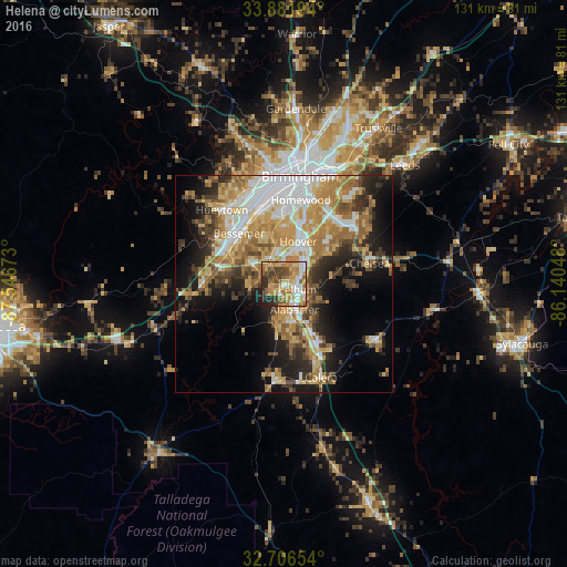
Analysis of Helena night lights 2016
Square area 10x10 km:
 8.39%
8.39%90-99
11.71%80-89
11.71%70-79
14.34%60-69
19.06%50-59
6.82%40-49
11.54%30-39
7.17%20-29
8.22%10-19
1.05%0-9
0%Square area 50x50 km:
6.97%90-99
6.2%80-89
6.09%70-79
7.41%60-69
7.59%50-59
4.43%40-49
4.29%30-39
4.99%20-29
6.69%10-19
11.74%0-9
33.59%Clear (daylight) street map image can be seen on geolist.org.
Map coordinates:
33° 52' 55" North, 87° 32' 48.2" West
33° 17' 46.4" North, 86° 50' 37" West
32° 42' 23.5" North, 86° 8' 25.7" West
Some cities around Helena sort by population:
• Hoover
12.5 km =7.8 mi,  13°
13°
• Vestavia Hills
17.7 km =11 mi,  17°
17°
• Alabaster
6.3 km =3.9 mi,  156°
156°
• Bessemer
15.6 km =9.7 mi,  318°
318°
• Homewood
19.9 km =12.4 mi, 11°
• Pelham
3.3 km =2.1 mi,  110°
110°
• Meadowbrook
18 km =11.2 mi,  49°
49°
• Midfield
19.4 km =12.1 mi,  341°
341°
4066811 (p: 18,264)
Sources (retrieved 2019-11-25):
» Earth at Night: Flat Maps 2012, 2016