Troy night lights from space
Night Light of Troy (Missouri) from space (United States) Src. Average luminocity for 10x10km area is 30.9367% and for 50x50km: 10.7581%.
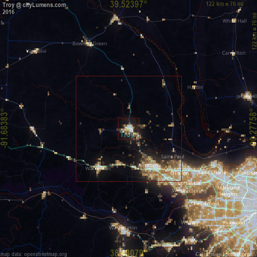
Analysis of Troy night lights 2016
Square area 10x10 km:
 3.41%
3.41%90-99
3.57%80-89
5.68%70-79
3.9%60-69
4.06%50-59
4.38%40-49
3.08%30-39
6.98%20-29
5.36%10-19
33.77%0-9
25.81%Square area 50x50 km:
1.09%90-99
1.35%80-89
1.83%70-79
1.69%60-69
1.81%50-59
1.48%40-49
1.52%30-39
2.07%20-29
2.04%10-19
6.15%0-9
78.96%Clear (daylight) street map image can be seen on geolist.org.
Map coordinates:
39° 31' 26.3" North, 91° 41' 1.8" West
38° 58' 46.2" North, 90° 58' 50.5" West
38° 25' 50.8" North, 90° 16' 39.3" West
Some cities around Troy sort by population:
• O'Fallon
30.7 km =19.1 mi,  127°
127°
• Saint Peters
36.6 km =22.7 mi,  123°
123°
• Wentzville
21.7 km =13.5 mi,  149°
149°
• Lake Saint Louis
26.3 km =16.3 mi,  140°
140°
• Dardenne Prairie
31.9 km =19.8 mi, 136°
• Warrenton
23.3 km =14.5 mi,  216°
216°
• Weldon Spring
38.9 km =24.2 mi, 139°
• Bowling Green
44.3 km =27.5 mi,  335°
335°
4412089 (p: 11,542)
Sources (retrieved 2019-11-25):
» Earth at Night: Flat Maps 2012, 2016