Manteca night lights from space
Night Light of Manteca (California) from space (United States) Src. Average luminocity for 10x10km area is 56.665% and for 50x50km: 26.7312%.
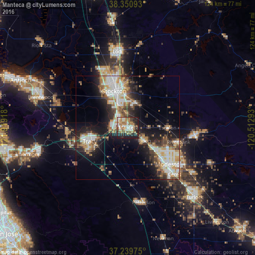

Analysis of Manteca night lights 2016
Square area 10x10 km:
 9.18%
9.18%90-99
10.71%80-89
3.4%70-79
10.71%60-69
14.97%50-59
10.37%40-49
5.27%30-39
7.14%20-29
19.56%10-19
8.67%0-9
0%Square area 50x50 km:
5.12%90-99
5.59%80-89
2.46%70-79
3.99%60-69
3.23%50-59
3.45%40-49
3.78%30-39
4.05%20-29
6.42%10-19
12.32%0-9
49.59%Clear (daylight) street map image can be seen on geolist.org.
Map coordinates:
38° 21' 3.3" North, 121° 55' 9" West
37° 47' 50.7" North, 121° 12' 57.8" West
37° 14' 23.1" North, 120° 30' 46.5" West
Some cities around Manteca sort by population:
• Stockton
19 km =11.8 mi,  339°
339°
• Tracy
19.5 km =12.1 mi,  250°
250°
• Lathrop
6 km =3.7 mi,  297°
297°
• Ripon
10.2 km =6.3 mi,  127°
127°
• Salida
15.4 km =9.6 mi, 131°
• Garden Acres
18.5 km =11.5 mi,  356°
356°
• August
20.6 km =12.8 mi,  348°
348°
• Escalon
19.2 km =11.9 mi,  89°
89°
5370164 (p: 75,448)
Sources (retrieved 2019-11-25):
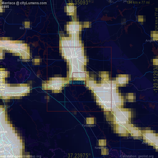
» NASA, Earths city lights 1995
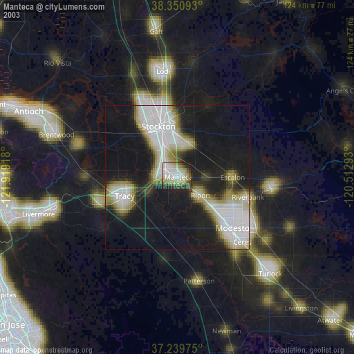
» NASA city lights 2003
» Earth at Night: Flat Maps 2012, 2016