Tipton night lights from space
Night Light of Tipton (Indiana) from space (United States) Src. Average luminocity for 10x10km area is 11.869% and for 50x50km: 7.9689%.
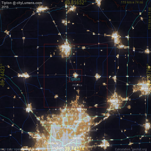
Analysis of Tipton night lights 2016
Square area 10x10 km:
 1.02%
1.02%90-99
1.7%80-89
0.85%70-79
2.21%60-69
2.72%50-59
0.51%40-49
0.85%30-39
2.38%20-29
2.72%10-19
1.02%0-9
84.01%Square area 50x50 km:
0.82%90-99
1.21%80-89
0.7%70-79
0.96%60-69
0.93%50-59
1.17%40-49
1.42%30-39
1.62%20-29
2.53%10-19
4.96%0-9
83.68%Clear (daylight) street map image can be seen on geolist.org.
Map coordinates:
40° 48' 59.5" North, 86° 44' 39.2" West
40° 16' 56.1" North, 86° 2' 28" West
39° 44' 37.5" North, 85° 20' 16.7" West
Some cities around Tipton sort by population:
• Carmel
34.4 km =21.4 mi,  190°
190°
• Fishers
36.4 km =22.6 mi,  176°
176°
• Noblesville
26.5 km =16.5 mi,  174°
174°
• Kokomo
24 km =14.9 mi,  340°
340°
• Anderson
36.4 km =22.6 mi,  122°
122°
• Westfield
27.6 km =17.1 mi,  195°
195°
• Elwood
16.9 km =10.5 mi,  91°
91°
• Alexandria
31.1 km =19.3 mi, 93°
4927242 (p: 5,144)
Sources (retrieved 2019-11-25):
» Earth at Night: Flat Maps 2012, 2016