Westfield night lights from space
Night Light of Westfield (Indiana) from space (United States) Src. Average luminocity for 10x10km area is 60.0536% and for 50x50km: 36.1369%.
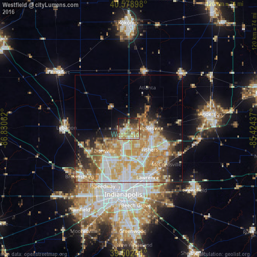

Analysis of Westfield night lights 2016
Square area 10x10 km:
 5.19%
5.19%90-99
12.01%80-89
11.85%70-79
12.5%60-69
13.96%50-59
11.69%40-49
5.19%30-39
7.47%20-29
10.23%10-19
9.09%0-9
0.81%Square area 50x50 km:
6.62%90-99
8.02%80-89
6.04%70-79
7.88%60-69
5.72%50-59
4.04%40-49
2.67%30-39
2.89%20-29
4.51%10-19
6.83%0-9
44.78%Clear (daylight) street map image can be seen on geolist.org.
Map coordinates:
40° 34' 44.3" North, 86° 49' 50.2" West
40° 2' 34.2" North, 86° 7' 39" West
39° 30' 8.7" North, 85° 25' 27.7" West
Some cities around Westfield sort by population:
• Carmel
7.2 km =4.5 mi,  173°
173°
• Fishers
13.7 km =8.5 mi,  135°
135°
• Noblesville
10.1 km =6.3 mi,  88°
88°
• Lawrence
24.3 km =15.1 mi,  158°
158°
• Zionsville
15.4 km =9.6 mi,  228°
228°
• Broad Ripple
19.6 km =12.2 mi,  183°
183°
• Whitestown
19.3 km =12 mi,  254°
254°
• McCordsville
23 km =14.3 mi,  130°
130°
4928118 (p: 36,738)
Sources (retrieved 2019-11-25):
» Earth at Night: Flat Maps 2012, 2016