Noblesville night lights from space
Night Light of Noblesville (Indiana) from space (United States) Src. Average luminocity for 10x10km area is 64.0032% and for 50x50km: 34.1318%.
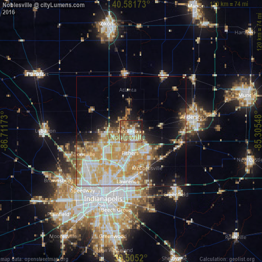

Analysis of Noblesville night lights 2016
Square area 10x10 km:
 7.47%
7.47%90-99
11.2%80-89
7.79%70-79
11.85%60-69
21.92%50-59
15.58%40-49
7.63%30-39
4.71%20-29
8.44%10-19
3.41%0-9
0%Square area 50x50 km:
6.18%90-99
7.54%80-89
5.8%70-79
7.45%60-69
5.13%50-59
3.32%40-49
2.39%30-39
2.51%20-29
4.18%10-19
8.71%0-9
46.8%Clear (daylight) street map image can be seen on geolist.org.
Map coordinates:
40° 34' 54.2" North, 86° 42' 42.2" West
40° 2' 44.1" North, 86° 0' 31" West
39° 30' 18.7" North, 85° 18' 19.7" West
Some cities around Noblesville sort by population:
• Carmel
11.9 km =7.4 mi,  231°
231°
• Fishers
10 km =6.2 mi,  182°
182°
• Lawrence
23.1 km =14.4 mi, 183°
• Westfield
10.1 km =6.3 mi,  268°
268°
• Zionsville
24 km =14.9 mi,  243°
243°
• Broad Ripple
22.9 km =14.2 mi,  209°
209°
• McCordsville
16.9 km =10.5 mi,  154°
154°
• Tipton
26.5 km =16.5 mi,  354°
354°
4924198 (p: 59,093)
Sources (retrieved 2019-11-25):
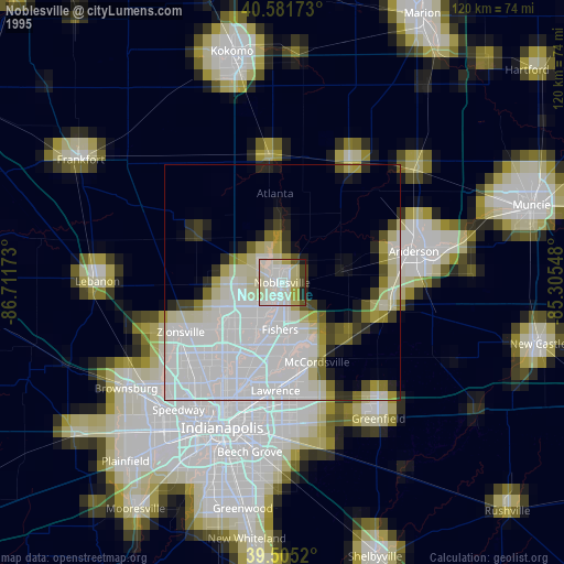
» NASA, Earths city lights 1995
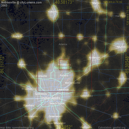
» NASA city lights 2003
» Earth at Night: Flat Maps 2012, 2016