Fishers night lights from space
Night Light of Fishers (Indiana) from space (United States) Src. Average luminocity for 10x10km area is 83.8214% and for 50x50km: 48.3825%.
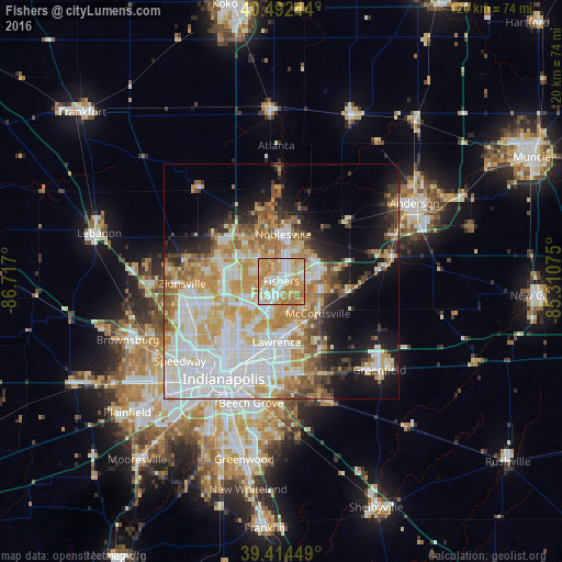
Analysis of Fishers night lights 2016
Square area 10x10 km:
 18.71%
90-99
20.75%80-89
13.1%70-79
33.16%60-69
13.61%50-59
0.68%40-49
0%30-39
0%20-29
0%10-19
0%0-9
0%Square area 50x50 km:
13.22%90-99
11.37%80-89
6.9%70-79
8.51%60-69
5.96%50-59
4.19%40-49
3%30-39
3.18%20-29
4.65%10-19
10.83%0-9
28.19%Clear (daylight) street map image can be seen on geolist.org.
Map coordinates:
40° 29' 32.8" North, 86° 43' 1.2" West
39° 57' 20.1" North, 86° 0' 49.9" West
39° 24' 52.2" North, 85° 18' 38.7" West
Some cities around Fishers sort by population:
• Carmel
9.2 km =5.7 mi,  285°
285°
• Noblesville
10 km =6.2 mi,  2°
2°
• Lawrence
13 km =8.1 mi,  184°
184°
• Westfield
13.7 km =8.5 mi,  315°
315°
• Zionsville
21.2 km =13.2 mi,  268°
268°
• Broad Ripple
14.7 km =9.1 mi,  227°
227°
• McCordsville
9.4 km =5.8 mi,  124°
124°
• Cumberland
20.5 km =12.7 mi,  166°
166°
4257494 (p: 76,794)
Sources (retrieved 2019-11-25):
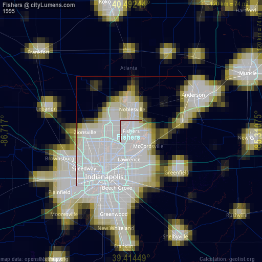
» NASA, Earths city lights 1995
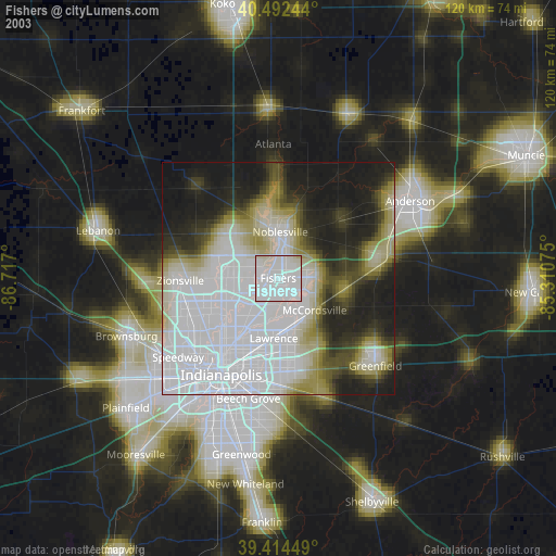
» NASA city lights 2003
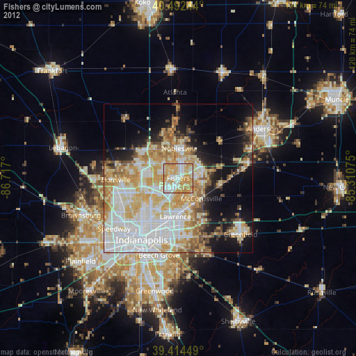
» Earth at Night: Flat Maps 2012, 2016