Thonotosassa night lights from space
Night Light of Thonotosassa (Florida) from space (United States) Src. Average luminocity for 10x10km area is 55.0909% and for 50x50km: 60.6912%.
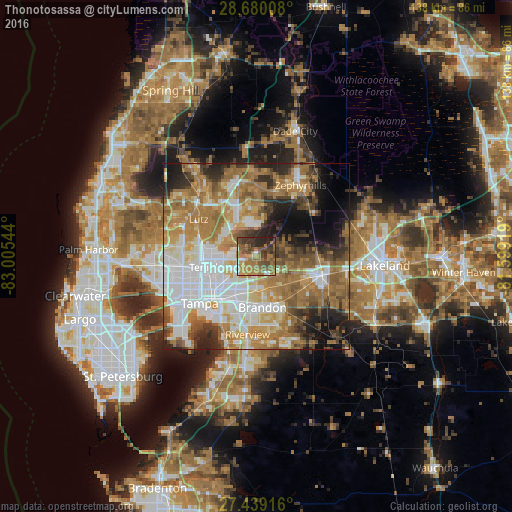
Analysis of Thonotosassa night lights 2016
Square area 10x10 km:
 1.89%
1.89%90-99
3.98%80-89
1.89%70-79
13.45%60-69
26.33%50-59
13.26%40-49
15.91%30-39
8.71%20-29
14.02%10-19
0.57%0-9
0%Square area 50x50 km:
14.76%90-99
10.97%80-89
6.07%70-79
8.44%60-69
18.33%50-59
7.32%40-49
6.44%30-39
5.47%20-29
7.6%10-19
7.74%0-9
6.86%Clear (daylight) street map image can be seen on geolist.org.
Map coordinates:
28° 40' 48.3" North, 83° 0' 19.6" West
28° 3' 41.1" North, 82° 18' 8.3" West
27° 26' 21" North, 81° 35' 57.1" West
Some cities around Thonotosassa sort by population:
• Brandon
13.8 km =8.6 mi,  173°
173°
• University
13.5 km =8.4 mi,  275°
275°
• Valrico
15.2 km =9.4 mi,  154°
154°
• Temple Terrace
9 km =5.6 mi,  251°
251°
• East Lake-Orient Park
11.5 km =7.1 mi,  220°
220°
• Mango
9.1 km =5.7 mi,  182°
182°
• Pebble Creek
10.6 km =6.6 mi,  336°
336°
• Seffner
9 km =5.6 mi,  163°
163°
4175269 (p: 13,014)
Sources (retrieved 2019-11-25):
» Earth at Night: Flat Maps 2012, 2016