University night lights from space
Night Light of University (Florida) from space (United States) Src. Average luminocity for 10x10km area is 91.1629% and for 50x50km: 66.9182%.
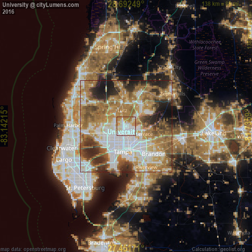
Analysis of University night lights 2016
Square area 10x10 km:
 39.77%
90-99
29.92%80-89
5.68%70-79
17.61%60-69
7.01%50-59
0%40-49
0%30-39
0%20-29
0%10-19
0%0-9
0%Square area 50x50 km:
16.47%90-99
12.8%80-89
7.23%70-79
9.77%60-69
19.66%50-59
7.69%40-49
6.65%30-39
5.53%20-29
8.52%10-19
5.11%0-9
0.58%Clear (daylight) street map image can be seen on geolist.org.
Map coordinates:
28° 41' 33" North, 83° 8' 31.7" West
28° 4' 26" North, 82° 26' 20.5" West
27° 27' 6.2" North, 81° 44' 9.2" West
Some cities around University sort by population:
• Carrollwood Village
8.1 km =5 mi,  264°
264°
• Egypt Lake-Leto
9.1 km =5.7 mi,  226°
226°
• Carrollwood
5.9 km =3.7 mi,  243°
243°
• Lake Magdalene
3.2 km =2 mi,  270°
270°
• Temple Terrace
6.5 km =4 mi,  131°
131°
• Greater Northdale
9.2 km =5.7 mi,  292°
292°
• Northdale
6.9 km =4.3 mi, 288°
• Lutz
8.9 km =5.5 mi,  345°
345°
7260219 (p: 41,163)
Sources (retrieved 2019-11-25):
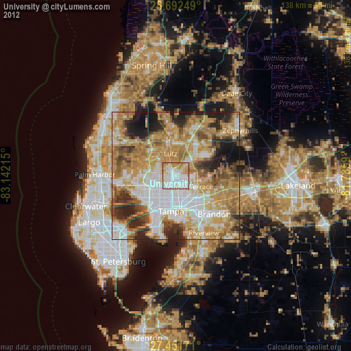
» Earth at Night: Flat Maps 2012, 2016