Brandon night lights from space
Night Light of Brandon (Florida) from space (United States) Src. Average luminocity for 10x10km area is 89.5436% and for 50x50km: 55.0902%.
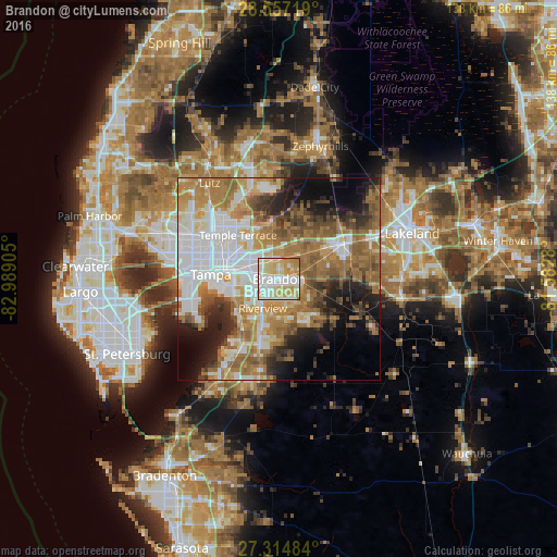
Analysis of Brandon night lights 2016
Square area 10x10 km:
 25.57%
90-99
27.65%80-89
27.08%70-79
15.34%60-69
4.36%50-59
0%40-49
0%30-39
0%20-29
0%10-19
0%0-9
0%Square area 50x50 km:
14%90-99
10.45%80-89
5.37%70-79
7.13%60-69
14.87%50-59
7.49%40-49
5.29%30-39
4.68%20-29
6.83%10-19
8.99%0-9
14.89%Clear (daylight) street map image can be seen on geolist.org.
Map coordinates:
28° 33' 25.9" North, 82° 59' 20.6" West
27° 56' 16.1" North, 82° 17' 9.3" West
27° 18' 53.4" North, 81° 34' 58.1" West
Some cities around Brandon sort by population:
• Riverview
8.9 km =5.5 mi,  206°
206°
• Valrico
4.9 km =3 mi,  89°
89°
• East Lake-Orient Park
10.4 km =6.5 mi,  298°
298°
• Bloomingdale
6.6 km =4.1 mi,  137°
137°
• Palm River-Clair Mel
9.3 km =5.8 mi,  260°
260°
• Mango
5.1 km =3.2 mi,  336°
336°
• Seffner
5.2 km =3.2 mi,  11°
11°
• Progress Village
8.8 km =5.5 mi,  241°
241°
4148757 (p: 103,483)
Sources (retrieved 2019-11-25):
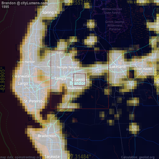
» NASA, Earths city lights 1995
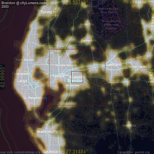
» NASA city lights 2003
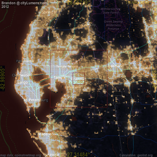
» Earth at Night: Flat Maps 2012, 2016