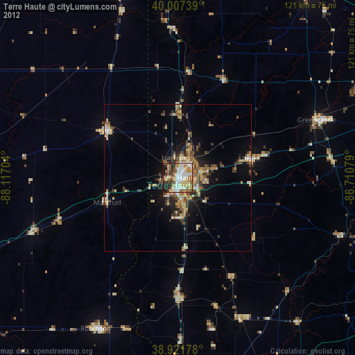
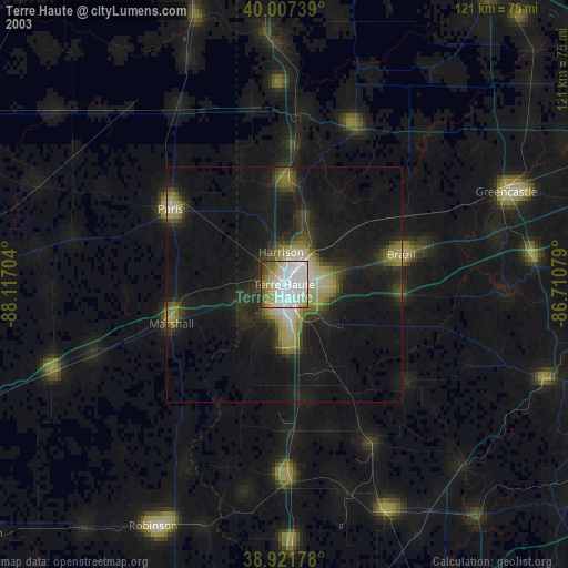
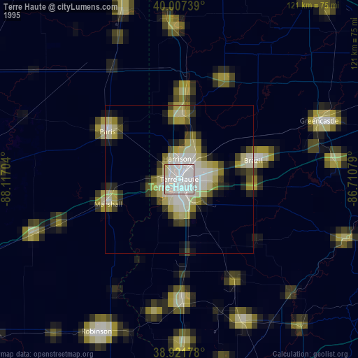
Terre Haute night lights from space
Night Light of Terre Haute (Indiana) from space (United States) Src. Average luminocity for 10x10km area is 63.4507% and for 50x50km: 9.1536%.
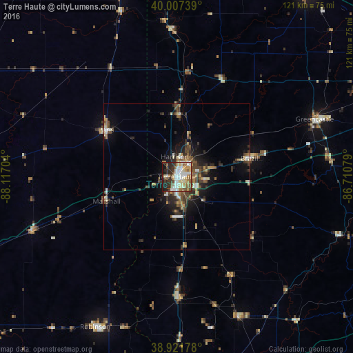
Analysis of Terre Haute night lights 2016
Square area 10x10 km:
 14.97%
90-99
16.67%80-89
8.5%70-79
7.48%60-69
6.46%50-59
10.2%40-49
6.12%30-39
7.14%20-29
13.78%10-19
8.5%0-9
0.17%Square area 50x50 km:
1.05%90-99
1.38%80-89
1.09%70-79
0.91%60-69
1.1%50-59
1.44%40-49
2.01%30-39
1.84%20-29
2.69%10-19
4.8%0-9
81.69%Clear (daylight) street map image can be seen on geolist.org.
Map coordinates:
40° 0' 26.6" North, 88° 7' 1.3" West
39° 28' 0.1" North, 87° 24' 50.1" West
38° 55' 18.4" North, 86° 42' 38.8" West
Some cities around Terre Haute sort by population:
• Danville
75.4 km =46.9 mi,  345°
345°
• Charleston
65.5 km =40.7 mi,  272°
272°
• Greencastle
51.1 km =31.8 mi,  67°
67°
• Paris
29 km =18 mi,  303°
303°
• Brazil
25.6 km =15.9 mi,  75°
75°
• Robinson
58.5 km =36.4 mi,  208°
208°
• Ellettsville
72.6 km =45.1 mi,  110°
110°
• Linton
52.6 km =32.7 mi,  156°
156°
4265737 (p: 60,825)
Sources (retrieved 2019-11-25):
» NASA, Earths city lights 1995
» NASA city lights 2003
» Earth at Night: Flat Maps 2012, 2016