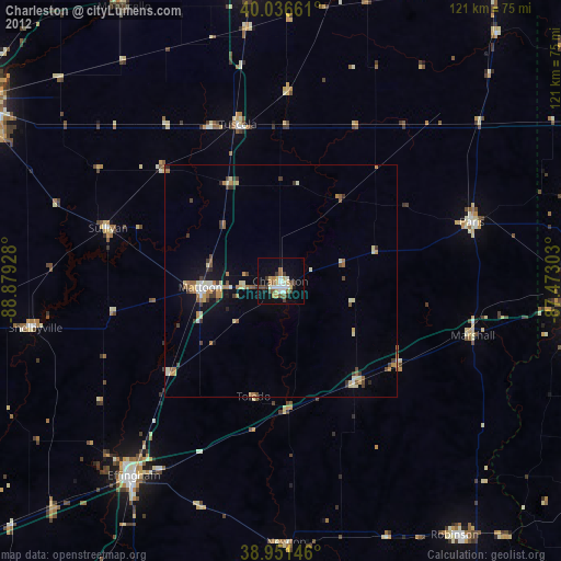
Charleston night lights from space
Night Light of Charleston (Illinois) from space (United States) Src. Average luminocity for 10x10km area is 23.9253% and for 50x50km: 4.5971%.
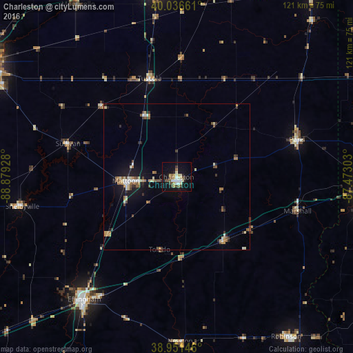
Analysis of Charleston night lights 2016
Square area 10x10 km:
 2.6%
2.6%90-99
4.87%80-89
3.73%70-79
2.44%60-69
0.81%50-59
4.06%40-49
4.22%30-39
1.14%20-29
2.92%10-19
25.16%0-9
48.05%Square area 50x50 km:
0.4%90-99
0.6%80-89
0.69%70-79
0.6%60-69
0.47%50-59
0.78%40-49
0.66%30-39
0.52%20-29
0.69%10-19
3.56%0-9
91.03%Clear (daylight) street map image can be seen on geolist.org.
Map coordinates:
40° 2' 11.8" North, 88° 52' 45.4" West
39° 29' 46.1" North, 88° 10' 34.1" West
38° 57' 5.3" North, 87° 28' 22.9" West
Some cities around Charleston sort by population:
• Terre Haute
65.5 km =40.7 mi,  92°
92°
• Mattoon
16.9 km =10.5 mi,  265°
265°
• Effingham
52.4 km =32.6 mi,  217°
217°
• Paris
43.1 km =26.8 mi,  72°
72°
• Savoy
62.4 km =38.8 mi,  354°
354°
• Robinson
66.3 km =41.2 mi,  145°
145°
• Mount Zion
67.2 km =41.8 mi,  297°
297°
• Monticello
68.2 km =42.4 mi,  330°
330°
4235668 (p: 21,196)
Sources (retrieved 2019-11-25):
» Earth at Night: Flat Maps 2012, 2016