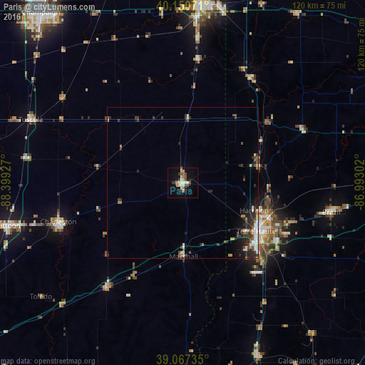
Paris night lights from space
Night Light of Paris (Illinois) from space (United States) Src. Average luminocity for 10x10km area is 19.138% and for 50x50km: 4.0208%.
Analysis of Paris night lights 2016
Square area 10x10 km:
 1.3%
1.3%90-99
3.25%80-89
3.41%70-79
2.6%60-69
3.08%50-59
0.65%40-49
4.55%30-39
2.11%20-29
1.14%10-19
10.39%0-9
67.53%Square area 50x50 km:
0.48%90-99
0.64%80-89
0.47%70-79
0.32%60-69
0.4%50-59
0.44%40-49
0.8%30-39
0.94%20-29
1.45%10-19
1.92%0-9
92.14%Clear (daylight) street map image can be seen on geolist.org.
Map coordinates:
40° 9' 2.6" North, 88° 23' 57.4" West
39° 36' 40.1" North, 87° 41' 46.1" West
39° 4' 2.5" North, 86° 59' 34.9" West
Some cities around Paris sort by population:
• Terre Haute
29 km =18 mi,  123°
123°
• Urbana
70.6 km =43.9 mi,  321°
321°
• Danville
57.4 km =35.7 mi,  5°
5°
• Charleston
43.1 km =26.8 mi,  252°
252°
• Mattoon
59.7 km =37.1 mi,  256°
256°
• Savoy
68.4 km =42.5 mi, 316°
• Brazil
49.9 km =31 mi,  101°
101°
• Robinson
67.5 km =41.9 mi,  183°
183°
4246659 (p: 8,432)
Sources (retrieved 2019-11-25):
» Earth at Night: Flat Maps 2012, 2016