Brazil night lights from space
Night Light of Brazil (Indiana) from space (United States) Src. Average luminocity for 10x10km area is 20.5487% and for 50x50km: 8.0765%.
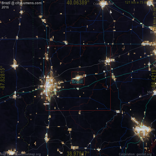
Analysis of Brazil night lights 2016
Square area 10x10 km:
 1.95%
1.95%90-99
1.62%80-89
4.06%70-79
0.97%60-69
1.79%50-59
4.06%40-49
5.36%30-39
3.57%20-29
1.79%10-19
18.34%0-9
56.49%Square area 50x50 km:
1.01%90-99
1.16%80-89
1.02%70-79
0.7%60-69
1.06%50-59
1.42%40-49
1.72%30-39
1.52%20-29
1.76%10-19
4.29%0-9
84.34%Clear (daylight) street map image can be seen on geolist.org.
Map coordinates:
40° 3' 50" North, 87° 49' 41.3" West
39° 31' 25.1" North, 87° 7' 30.1" West
38° 58' 45" North, 86° 25' 18.8" West
Some cities around Brazil sort by population:
• Terre Haute
25.6 km =15.9 mi,  255°
255°
• Crawfordsville
61.4 km =38.2 mi,  20°
20°
• Martinsville
60.7 km =37.7 mi,  100°
100°
• Greencastle
26 km =16.2 mi,  58°
58°
• Danville
57.6 km =35.8 mi, 62°
• Paris
49.9 km =31 mi,  281°
281°
• Ellettsville
53.7 km =33.4 mi,  126°
126°
• Linton
54.5 km =33.9 mi,  183°
183°
4254884 (p: 8,109)
Sources (retrieved 2019-11-25):
» Earth at Night: Flat Maps 2012, 2016