Bear Valley Springs night lights from space
Night Light of Bear Valley Springs (California) from space (United States) Src. Average luminocity for 10x10km area is 1.007% and for 50x50km: 2.487%.
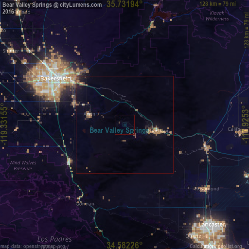
Analysis of Bear Valley Springs night lights 2016
Square area 10x10 km:
 0%
0%90-99
0%80-89
0%70-79
0%60-69
0%50-59
0%40-49
1.75%30-39
0%20-29
0.35%10-19
0%0-9
97.9%Square area 50x50 km:
0.03%90-99
0.08%80-89
0.12%70-79
0.37%60-69
0.58%50-59
0.55%40-49
0.79%30-39
0.48%20-29
0.32%10-19
1.63%0-9
95.05%Clear (daylight) street map image can be seen on geolist.org.
Map coordinates:
35° 43' 55" North, 119° 19' 53.6" West
35° 9' 32.9" North, 118° 37' 42.3" West
34° 34' 56.1" North, 117° 55' 31.1" West
Some cities around Bear Valley Springs sort by population:
• Bakersfield
42.7 km =26.5 mi,  303°
303°
• Oildale
45.8 km =28.5 mi,  309°
309°
• Arvin
19 km =11.8 mi,  287°
287°
• Lamont
28.3 km =17.6 mi, 293°
• Rosedale
53.2 km =33.1 mi, 298°
• Tehachapi
16.6 km =10.3 mi,  100°
100°
• Golden Hills
12.7 km =7.9 mi, 98°
• Greenacres
50.3 km =31.3 mi, 299°
5327003 (p: 5,172)
Sources (retrieved 2019-11-25):
» Earth at Night: Flat Maps 2012, 2016