Arvin night lights from space
Night Light of Arvin (California) from space (United States) Src. Average luminocity for 10x10km area is 10.7045% and for 50x50km: 12.3608%.
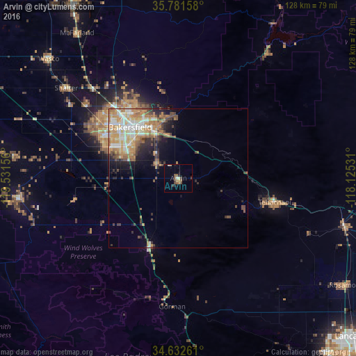
Analysis of Arvin night lights 2016
Square area 10x10 km:
 0.35%
0.35%90-99
1.05%80-89
1.4%70-79
1.57%60-69
0.7%50-59
3.32%40-49
1.75%30-39
2.1%20-29
0.87%10-19
2.97%0-9
83.92%Square area 50x50 km:
1.84%90-99
2.48%80-89
1.44%70-79
2.22%60-69
2.5%50-59
1.57%40-49
1.82%30-39
1.42%20-29
1.81%10-19
3.48%0-9
79.43%Clear (daylight) street map image can be seen on geolist.org.
Map coordinates:
35° 46' 53.7" North, 119° 31' 53.6" West
35° 12' 32.9" North, 118° 49' 42.3" West
34° 37' 57.4" North, 118° 7' 31.1" West
Some cities around Arvin sort by population:
• Bakersfield
25.1 km =15.6 mi,  316°
316°
• Oildale
29.1 km =18.1 mi, 323°
• Lamont
9.6 km =6 mi,  305°
305°
• Rosedale
34.7 km =21.6 mi,  303°
303°
• Tehachapi
35.5 km =22.1 mi,  103°
103°
• Golden Hills
31.6 km =19.6 mi, 103°
• Greenacres
32 km =19.9 mi, 307°
• Bear Valley Springs
19 km =11.8 mi,  107°
107°
5324903 (p: 20,876)
Sources (retrieved 2019-11-25):
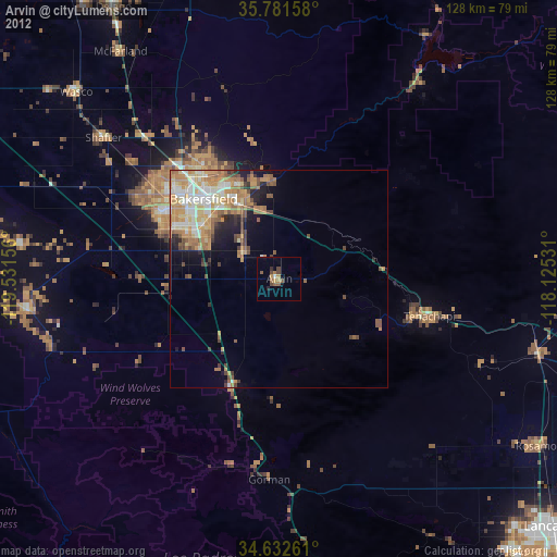
» Earth at Night: Flat Maps 2012, 2016