Swampscott night lights from space
Night Light of Swampscott (Massachusetts) from space (United States) Src. Average luminocity for 10x10km area is 59.3857% and for 50x50km: 39.4059%.
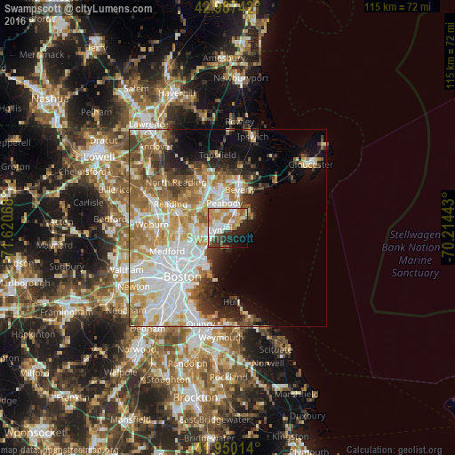
Analysis of Swampscott night lights 2016
Square area 10x10 km:
 11.59%
90-99
14.6%80-89
6.35%70-79
14.13%60-69
10.95%50-59
4.44%40-49
3.17%30-39
6.67%20-29
11.9%10-19
10.79%0-9
5.4%Square area 50x50 km:
10.99%90-99
8.54%80-89
4.55%70-79
5.5%60-69
6.33%50-59
4.92%40-49
3.15%30-39
3.49%20-29
4.82%10-19
6.84%0-9
40.87%Clear (daylight) street map image can be seen on geolist.org.
Map coordinates:
42° 59' 14.7" North, 71° 37' 14.4" West
42° 28' 15.3" North, 70° 55' 3.2" West
41° 57' 0.5" North, 70° 12' 51.9" West
Some cities around Swampscott sort by population:
• Lynn
2.7 km =1.7 mi,  259°
259°
• Revere
10.4 km =6.5 mi,  228°
228°
• Peabody
6.4 km =4 mi,  351°
351°
• South Peabody
5.1 km =3.2 mi,  328°
328°
• Salem
5.7 km =3.5 mi,  17°
17°
• Beverly
10.2 km =6.3 mi, 17°
• Saugus
7.6 km =4.7 mi, 264°
• Marblehead
5.9 km =3.7 mi,  56°
56°
4952468 (p: 13,787)
Sources (retrieved 2019-11-25):
» Earth at Night: Flat Maps 2012, 2016