Peabody night lights from space
Night Light of Peabody (Massachusetts) from space (United States) Src. Average luminocity for 10x10km area is 84.1873% and for 50x50km: 38.3573%.
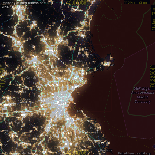
Analysis of Peabody night lights 2016
Square area 10x10 km:
 23.97%
90-99
25.87%80-89
9.05%70-79
18.1%60-69
16.03%50-59
4.76%40-49
1.75%30-39
0.48%20-29
0%10-19
0%0-9
0%Square area 50x50 km:
9.96%90-99
7.86%80-89
4.58%70-79
5.5%60-69
6.57%50-59
5.34%40-49
3.45%30-39
3.46%20-29
4.82%10-19
7.05%0-9
41.41%Clear (daylight) street map image can be seen on geolist.org.
Map coordinates:
43° 2' 38" North, 71° 37' 54.4" West
42° 31' 40.3" North, 70° 55' 43.2" West
42° 0' 27.2" North, 70° 13' 31.9" West
Some cities around Peabody sort by population:
• Lynn
7 km =4.3 mi,  194°
194°
• South Peabody
2.6 km =1.6 mi,  220°
220°
• Salem
2.8 km =1.7 mi,  109°
109°
• Beverly
5.2 km =3.2 mi,  49°
49°
• Beverly Cove
6.8 km =4.2 mi,  65°
65°
• Danvers
5.3 km =3.3 mi,  358°
358°
• Marblehead
6.6 km =4.1 mi,  118°
118°
• Swampscott
6.4 km =4 mi,  171°
171°
4946863 (p: 52,504)
Sources (retrieved 2019-11-25):
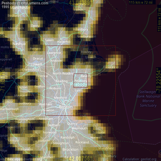
» NASA, Earths city lights 1995
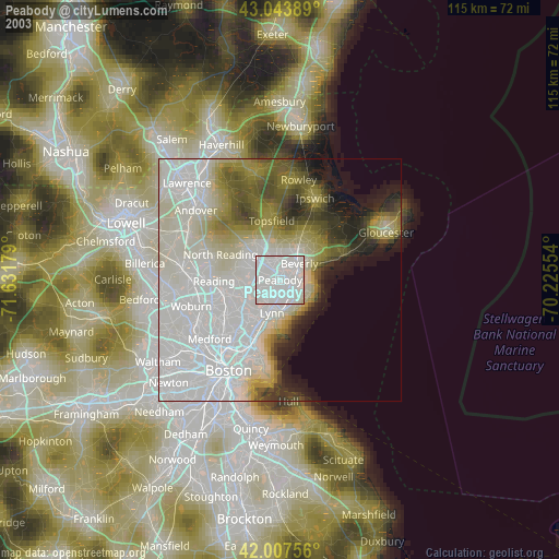
» NASA city lights 2003
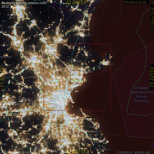
» Earth at Night: Flat Maps 2012, 2016