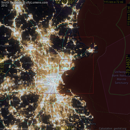
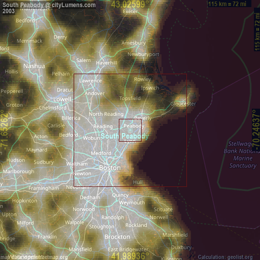
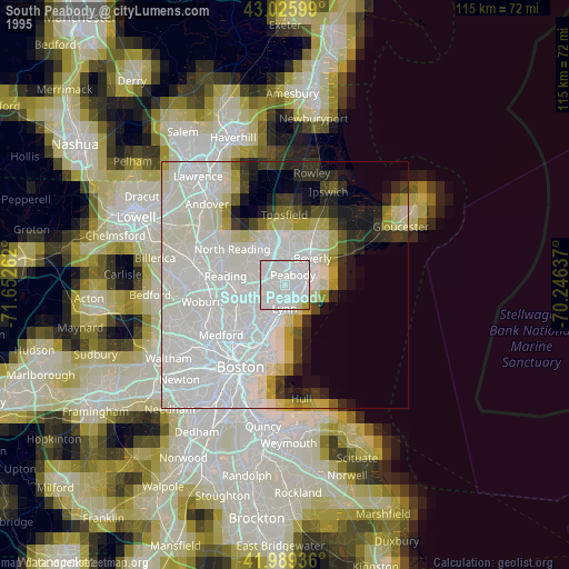
South Peabody night lights from space
Night Light of South Peabody (Massachusetts) from space (United States) Src. Average luminocity for 10x10km area is 84.673% and for 50x50km: 41.2084%.
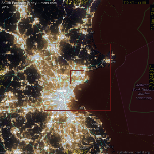
Analysis of South Peabody night lights 2016
Square area 10x10 km:
 22.54%
90-99
26.51%80-89
11.43%70-79
19.37%60-69
14.29%50-59
5.71%40-49
0.16%30-39
0%20-29
0%10-19
0%0-9
0%Square area 50x50 km:
10.83%90-99
8.72%80-89
4.83%70-79
5.83%60-69
6.92%50-59
6%40-49
3.65%30-39
3.56%20-29
4.88%10-19
7.18%0-9
37.6%Clear (daylight) street map image can be seen on geolist.org.
Map coordinates:
43° 1' 33.6" North, 71° 39' 9.4" West
42° 30' 35.4" North, 70° 56' 58.2" West
41° 59' 21.7" North, 70° 14' 46.9" West
Some cities around South Peabody sort by population:
• Lynn
4.8 km =3 mi,  180°
180°
• Peabody
2.6 km =1.6 mi,  40°
40°
• Salem
4.5 km =2.8 mi,  75°
75°
• Beverly
7.8 km =4.8 mi,  46°
46°
• Saugus
7 km =4.3 mi,  224°
224°
• Danvers
7.4 km =4.6 mi,  12°
12°
• Marblehead
7.6 km =4.7 mi,  98°
98°
• Swampscott
5.1 km =3.2 mi,  148°
148°
4951473 (p: 50,293)
Sources (retrieved 2019-11-25):
» NASA, Earths city lights 1995
» NASA city lights 2003
» Earth at Night: Flat Maps 2012, 2016