Suwanee night lights from space
Night Light of Suwanee (Georgia) from space (United States) Src. Average luminocity for 10x10km area is 84.3252% and for 50x50km: 74.3913%.
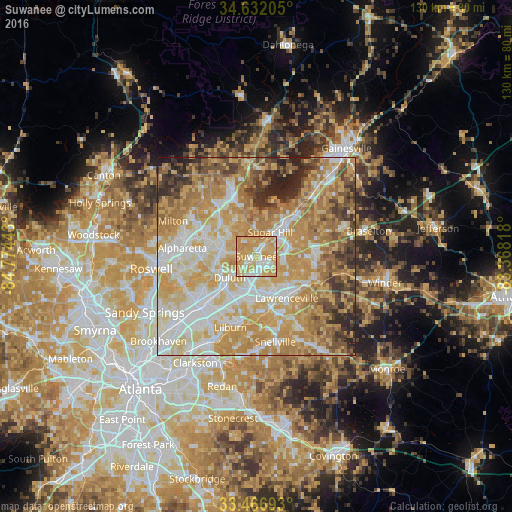
Analysis of Suwanee night lights 2016
Square area 10x10 km:
 15.21%
90-99
15.38%80-89
27.97%70-79
38.29%60-69
3.15%50-59
0%40-49
0%30-39
0%20-29
0%10-19
0%0-9
0%Square area 50x50 km:
14.74%90-99
14.89%80-89
16.37%70-79
19.81%60-69
12.93%50-59
5.83%40-49
5.22%30-39
4.69%20-29
4.58%10-19
0.93%0-9
0%Clear (daylight) street map image can be seen on geolist.org.
Map coordinates:
34° 37' 55.4" North, 84° 46' 27.9" West
34° 3' 5.4" North, 84° 4' 16.7" West
33° 28' 0.9" North, 83° 22' 5.4" West
Some cities around Suwanee sort by population:
• Johns Creek
12 km =7.5 mi,  257°
257°
• Peachtree Corners
16.5 km =10.3 mi,  236°
236°
• Lawrenceville
13.1 km =8.1 mi,  144°
144°
• Duluth
8.7 km =5.4 mi,  231°
231°
• Sugar Hill
7 km =4.3 mi,  29°
29°
• Norcross
18 km =11.2 mi, 226°
• Buford
9.9 km =6.2 mi,  38°
38°
• Dacula
17.4 km =10.8 mi,  113°
113°
4225309 (p: 18,694)
Sources (retrieved 2019-11-25):
» Earth at Night: Flat Maps 2012, 2016