Sugar Hill night lights from space
Night Light of Sugar Hill (Georgia) from space (United States) Src. Average luminocity for 10x10km area is 81.3736% and for 50x50km: 68.7656%.
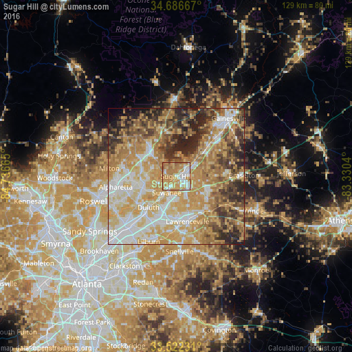
Analysis of Sugar Hill night lights 2016
Square area 10x10 km:
 17.4%
17.4%90-99
15.75%80-89
14.84%70-79
29.12%60-69
19.41%50-59
3.48%40-49
0%30-39
0%20-29
0%10-19
0%0-9
0%Square area 50x50 km:
12.67%90-99
12.24%80-89
14.59%70-79
17.18%60-69
12.33%50-59
6.48%40-49
7.07%30-39
6.89%20-29
7.39%10-19
2.29%0-9
0.87%Clear (daylight) street map image can be seen on geolist.org.
Map coordinates:
34° 41' 12" North, 84° 44' 11.9" West
34° 6' 23.4" North, 84° 2' 0.7" West
33° 31' 20.3" North, 83° 19' 49.4" West
Some cities around Sugar Hill sort by population:
• Johns Creek
17.5 km =10.9 mi,  240°
240°
• Lawrenceville
17.2 km =10.7 mi,  165°
165°
• Duluth
15.4 km =9.6 mi,  221°
221°
• Suwanee
7 km =4.3 mi,  209°
209°
• Buford
3.1 km =1.9 mi,  59°
59°
• Flowery Branch
13.3 km =8.3 mi,  48°
48°
• Cumming
14.9 km =9.3 mi,  318°
318°
• Dacula
18.1 km =11.2 mi,  136°
136°
4225039 (p: 21,747)
Sources (retrieved 2019-11-25):
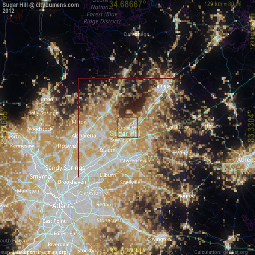
» Earth at Night: Flat Maps 2012, 2016