Cheverly night lights from space
Night Light of Cheverly (Maryland) from space (United States) Src. Average luminocity for 10x10km area is 99.4728% and for 50x50km: 74.7288%.
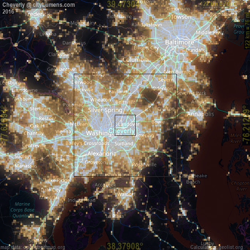
Analysis of Cheverly night lights 2016
Square area 10x10 km:
 81.29%
90-99
17.01%80-89
1.7%70-79
0%60-69
0%50-59
0%40-49
0%30-39
0%20-29
0%10-19
0%0-9
0%Square area 50x50 km:
23.57%90-99
18.32%80-89
11.39%70-79
12.63%60-69
9.78%50-59
7.23%40-49
3.98%30-39
3.68%20-29
2.14%10-19
2.37%0-9
4.89%Clear (daylight) street map image can be seen on geolist.org.
Map coordinates:
39° 28' 22.9" North, 77° 37' 8.2" West
38° 55' 41.4" North, 76° 54' 56.9" West
38° 22' 44.7" North, 76° 12' 45.7" West
Some cities around Cheverly sort by population:
• Landover
1.8 km =1.1 mi,  68°
68°
• Hyattsville
4 km =2.5 mi,  320°
320°
• East Riverdale
3.8 km =2.4 mi,  352°
352°
• Bladensburg
2 km =1.2 mi,  308°
308°
• Mount Rainier
4.5 km =2.8 mi,  289°
289°
• Riverdale Park
4.2 km =2.6 mi,  340°
340°
• Woodlawn
3.2 km =2 mi,  41°
41°
• Glenarden
4.7 km =2.9 mi,  88°
88°
4351327 (p: 6,485)
Sources (retrieved 2019-11-25):
» Earth at Night: Flat Maps 2012, 2016